MyTopo
Fergus Montana US Topo Map
Couldn't load pickup availability
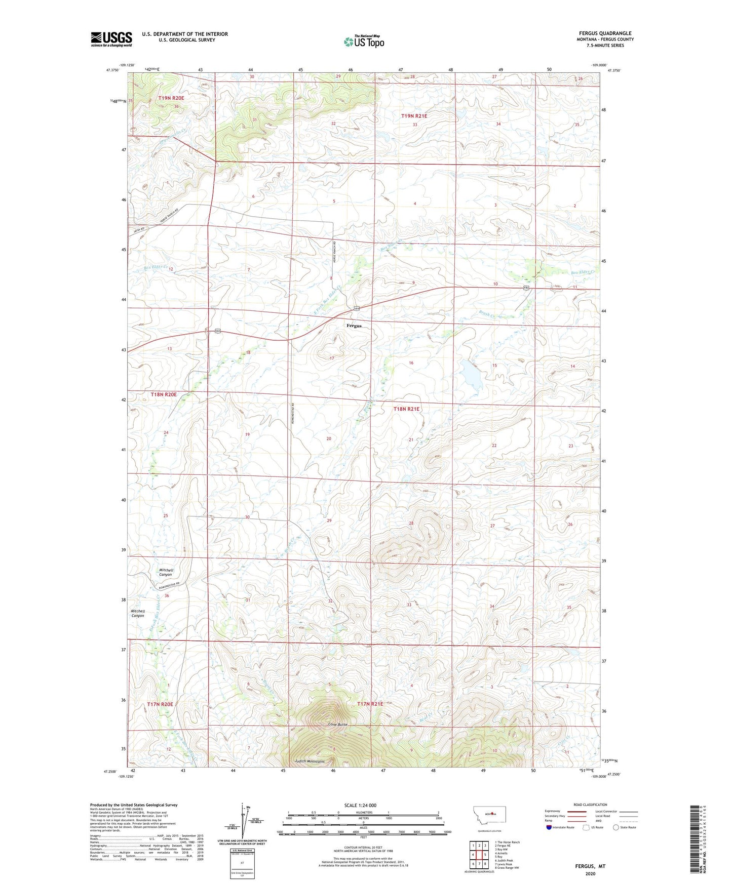
2024 topographic map quadrangle Fergus in the state of Montana. Scale: 1:24000. Based on the newly updated USGS 7.5' US Topo map series, this map is in the following counties: Fergus. The map contains contour data, water features, and other items you are used to seeing on USGS maps, but also has updated roads and other features. This is the next generation of topographic maps. Printed on high-quality waterproof paper with UV fade-resistant inks.
Quads adjacent to this one:
West: Armells
Northwest: The Horse Ranch
North: Fergus NE
Northeast: Roy NW
East: Roy
Southeast: Grass Range NW
South: Lewis Peak
Southwest: Judith Peak
This map covers the same area as the classic USGS quad with code o47109c1.
Contains the following named places: Brush Creek, Cone Butte, East Fork Box Elder Creek, Elderly Dam, Fergus, Fergus Post Office, Mitchell Canyon, Rindal Dam, Rindal Reservoir, Romundstad, Romundstad School