MyTopo
Treasure Mountain Montana US Topo Map
Couldn't load pickup availability
Also explore the Treasure Mountain Forest Service Topo of this same quad for updated USFS data
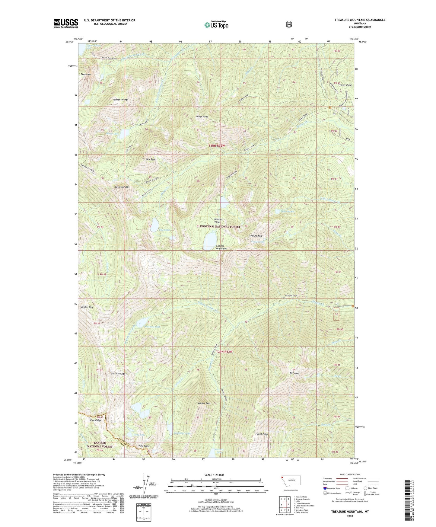
2024 topographic map quadrangle Treasure Mountain in the state of Montana. Scale: 1:24000. Based on the newly updated USGS 7.5' US Topo map series, this map is in the following counties: Lincoln, Sanders. The map contains contour data, water features, and other items you are used to seeing on USGS maps, but also has updated roads and other features. This is the next generation of topographic maps. Printed on high-quality waterproof paper with UV fade-resistant inks.
Quads adjacent to this one:
West: Crowell Mountain
Northwest: Kootenai Falls
North: Scenery Mountain
Northeast: Libby
East: Little Hoodoo Mountain
Southeast: Cable Mountain
South: Snowshoe Peak
Southwest: Ibex Peak
This map covers the same area as the classic USGS quad with code o48115c6.
Contains the following named places: Contact Creek, Crater Lake, Double Lake, Flavel Ridge, Flower Lake, Flower Point, Gus Brink Mountain, Hanging Valley, Houser Peak, Indian Head, Klatawa Lake, Lake Osakis, Minor Lake, Mount Snowy, North Fork Parmenter Creek, Parmenter Mountain, Silver Mountain Mine, Sky Lakes, South Fork Parmenter Creek, Sugarloaf Mountain, Treasure Mountain, Victor-Empire Mine, Vimy Lake, Weir Peak, West Fork Granite Creek, Wishbone Lake