MyTopo
Scenery Mountain Montana US Topo Map
Couldn't load pickup availability
Also explore the Scenery Mountain Forest Service Topo of this same quad for updated USFS data
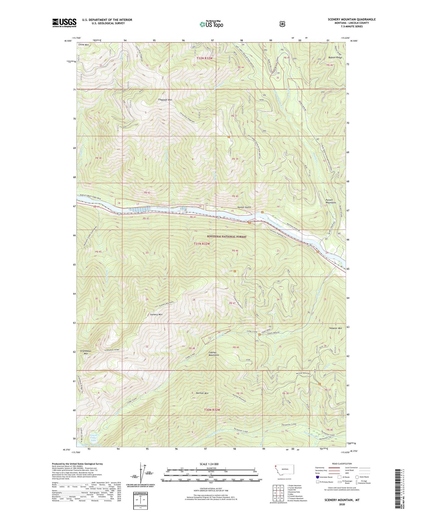
2024 topographic map quadrangle Scenery Mountain in the state of Montana. Scale: 1:24000. Based on the newly updated USGS 7.5' US Topo map series, this map is in the following counties: Lincoln. The map contains contour data, water features, and other items you are used to seeing on USGS maps, but also has updated roads and other features. This is the next generation of topographic maps. Printed on high-quality waterproof paper with UV fade-resistant inks.
Quads adjacent to this one:
West: Kootenai Falls
Northwest: Pulpit Mountain
North: Turner Mountain
Northeast: Gold Hill
East: Libby
Southeast: Little Hoodoo Mountain
South: Treasure Mountain
Southwest: Crowell Mountain
This map covers the same area as the classic USGS quad with code o48115d6.
Contains the following named places: 30N31W09CAA01_ Well, 31N32W24DAAC01 Well, Bob C Creek, Bobtail Ridge, Burrell Creek, Cedar Creek, China Creek, Dad Creek, Flagstaff Mountain, Grambauer Mountain, Hunter Gulch, Lamoka Creek, Lower Cedar Lake, Norman Mountain, Quartz Creek, Rankin, Samater Mountain, Scenery Mountain, Scenery Mountain Lookout Station, West Fork Quartz Creek, Williams Creek