MyTopo
Tunis Montana US Topo Map
Couldn't load pickup availability
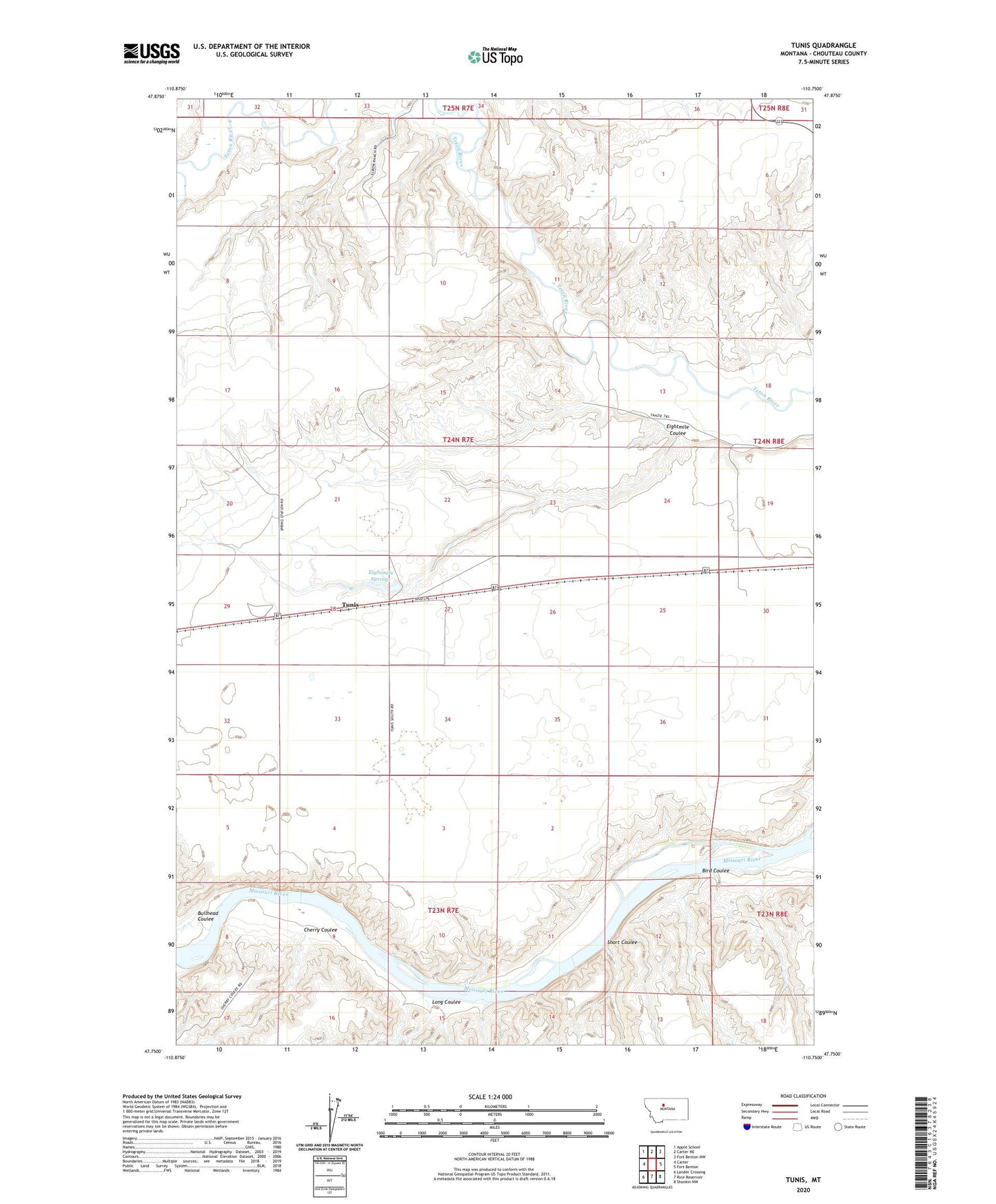
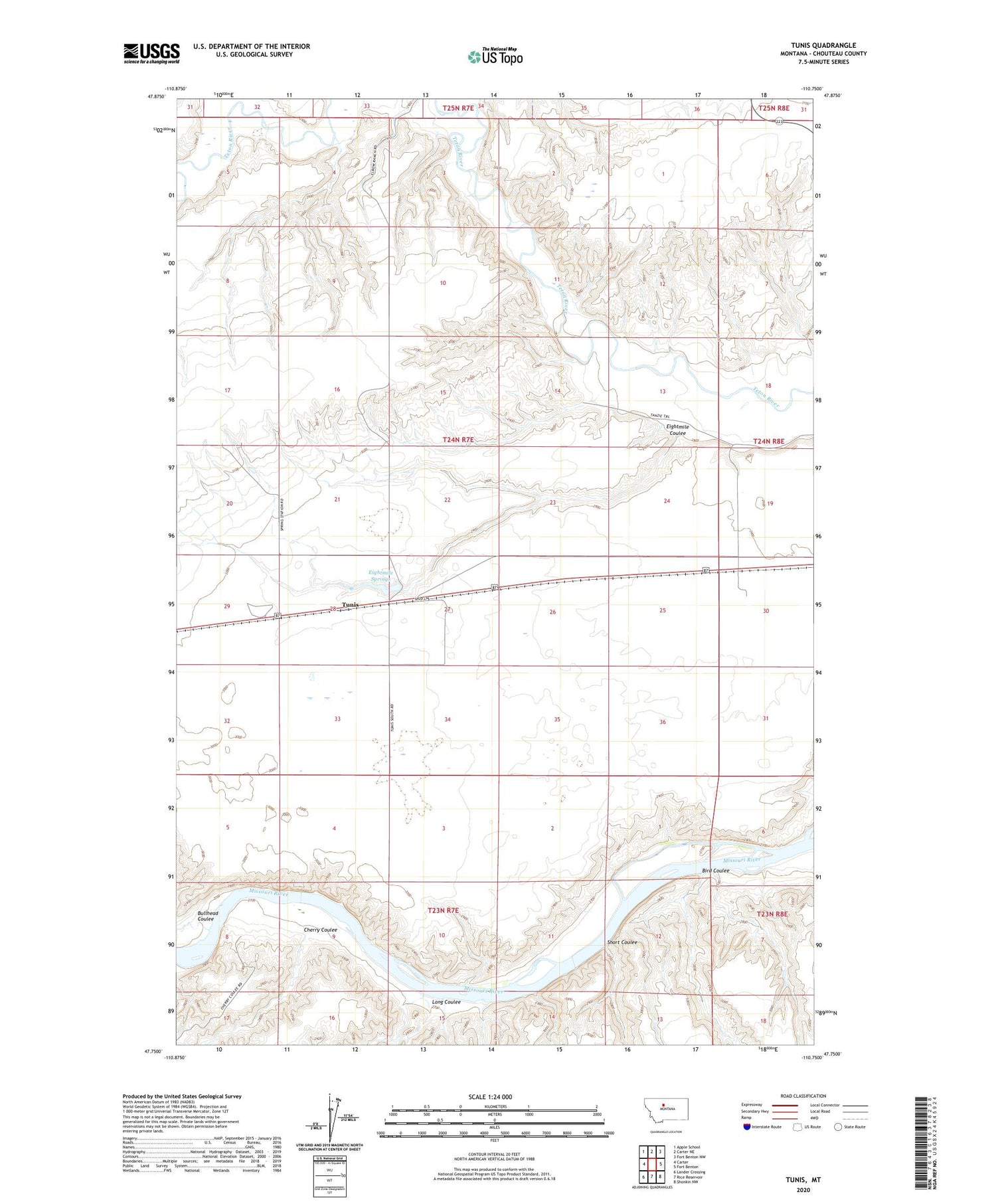
2020 topographic map quadrangle Tunis in the state of Montana. Scale: 1:24000. Based on the newly updated USGS 7.5' US Topo map series, this map is in the following counties: Chouteau. The map contains contour data, water features, and other items you are used to seeing on USGS maps, but also has updated roads and other features. This is the next generation of topographic maps. Printed on high-quality waterproof paper with UV fade-resistant inks.
Quads adjacent to this one:
West: Carter
Northwest: Apple School
North: Carter NE
Northeast: Fort Benton NW
East: Fort Benton
Southeast: Shonkin NW
South: Rice Reservoir
Southwest: Lander Crossing
Contains the following named places: Big Coulee, Bird Coulee, Bullhead Coulee, Cherry Coulee, Eight Mile Springs, Eightmile Coulee, Eightmile Springs, Eithtmile Spring Dam, Long Coulee, Short Coulee, Teton Post Office, Tunis, Tunis Post Office, Tunis School