MyTopo
Acorn Flats Montana US Topo Map
Couldn't load pickup availability
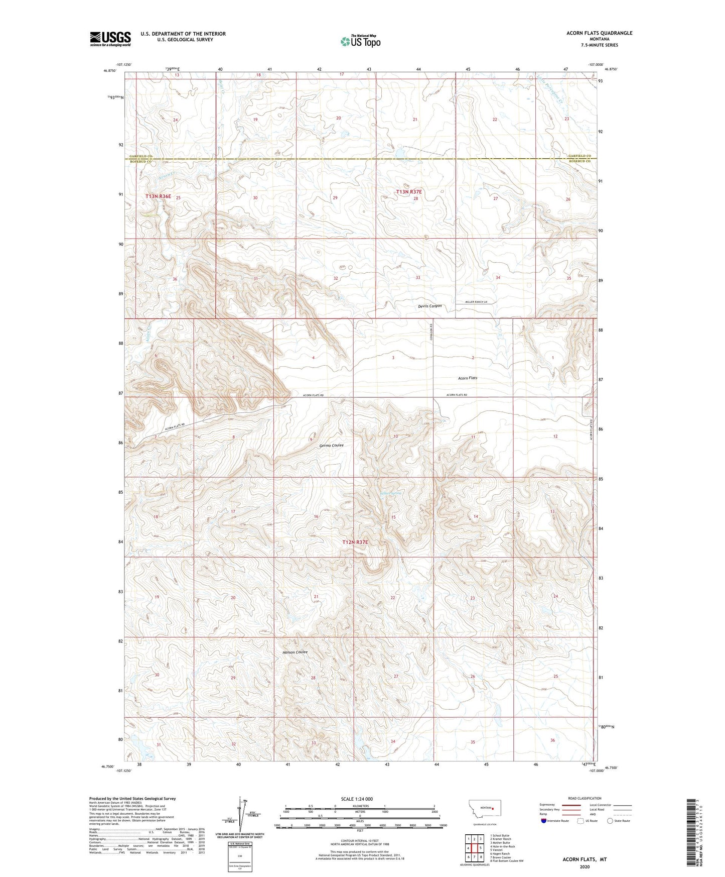
2024 topographic map quadrangle Acorn Flats in the state of Montana. Scale: 1:24000. Based on the newly updated USGS 7.5' US Topo map series, this map is in the following counties: Rosebud, Garfield. The map contains contour data, water features, and other items you are used to seeing on USGS maps, but also has updated roads and other features. This is the next generation of topographic maps. Printed on high-quality waterproof paper with UV fade-resistant inks.
Quads adjacent to this one:
West: Hole-in-the-Rock
Northwest: School Butte
North: Kramer Ranch
Northeast: Mother Butte
East: Vanstel
Southeast: Flat Bottom Coulee NW
South: Brown Coulee
Southwest: Hagen Ranch
This map covers the same area as the classic USGS quad with code o46107g1.
Contains the following named places: Acorn Flats, Bass Dam, Big Timber Number 5 Dam, Elmer Post Office, Elmer School, Galt Number 32 Dam, Heist Creek, Mud Springs School, Schlesinger Number 3 Dam, US Number 13 Dam, Wilkes Spring