MyTopo
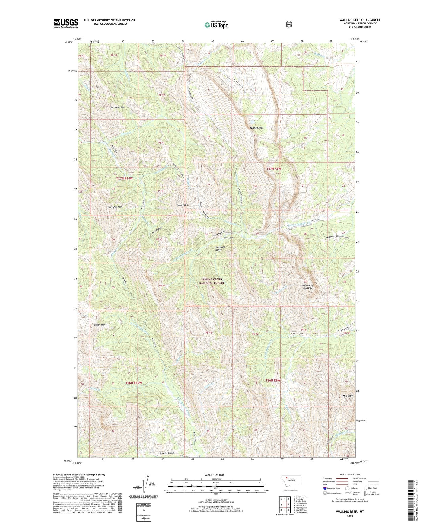
Walling Reef Montana US Topo Map
Couldn't load pickup availability
Also explore the Walling Reef Forest Service Topo of this same quad for updated USFS data
2024 topographic map quadrangle Walling Reef in the state of Montana. Scale: 1:24000. Based on the newly updated USGS 7.5' US Topo map series, this map is in the following counties: Teton. The map contains contour data, water features, and other items you are used to seeing on USGS maps, but also has updated roads and other features. This is the next generation of topographic maps. Printed on high-quality waterproof paper with UV fade-resistant inks.
Quads adjacent to this one:
West: Gateway Pass
Northwest: Swift Reservoir
North: Fish Lake
Northeast: Scoffin Butte
East: Volcano Reef
Southeast: Cave Mountain
South: Mount Wright
Southwest: Porphyry Reef
This map covers the same area as the classic USGS quad with code o48112a7.
Contains the following named places: Bennie Creek, Bennie Hill, Bloody Hill, Bum Shot Mountain, Canyon Creek, Fright Creek, Happy Creek, Hoy Gulch, Hurricane Mountain, Kid Creek, Mount Frazier, Nanny Creek, Old Man of the Hills, Potshot Creek, Rival Creek, South Creek, Steedling Creek, Walling Reef, Washout Creek