MyTopo
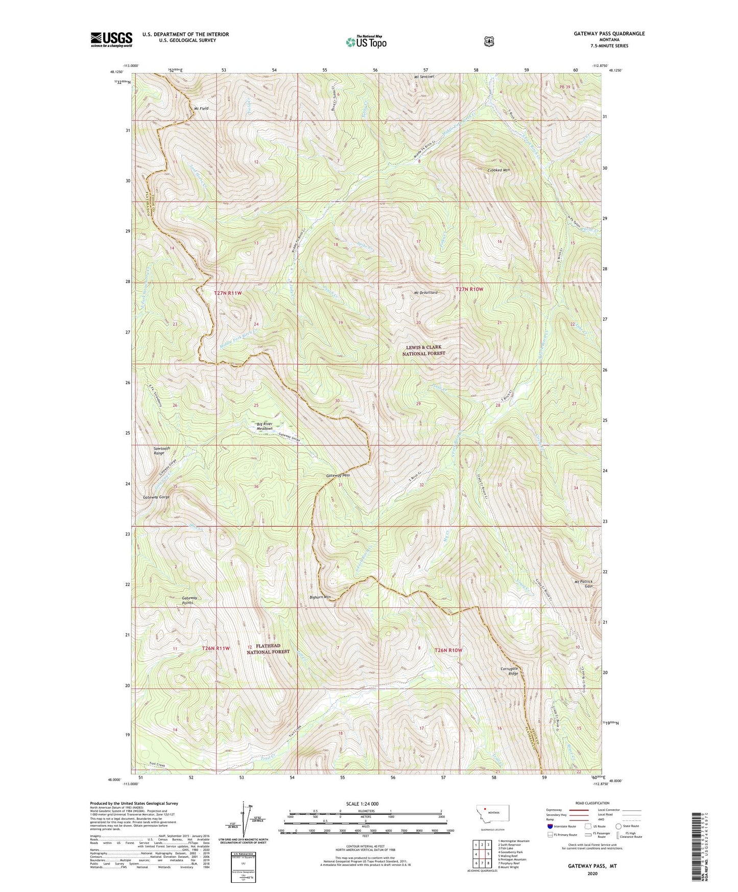
Gateway Pass Montana US Topo Map
Couldn't load pickup availability
Also explore the Gateway Pass Forest Service Topo of this same quad for updated USFS data
2024 topographic map quadrangle Gateway Pass in the state of Montana. Scale: 1:24000. Based on the newly updated USGS 7.5' US Topo map series, this map is in the following counties: Teton, Flathead. The map contains contour data, water features, and other items you are used to seeing on USGS maps, but also has updated roads and other features. This is the next generation of topographic maps. Printed on high-quality waterproof paper with UV fade-resistant inks.
Quads adjacent to this one:
West: Gooseberry Park
Northwest: Morningstar Mountain
North: Swift Reservoir
Northeast: Fish Lake
East: Walling Reef
Southeast: Mount Wright
South: Porphyry Reef
Southwest: Pentagon Mountain
This map covers the same area as the classic USGS quad with code o48112a8.
Contains the following named places: Big River Meadows, Bighorn Mountain, Circus Creek, Corrugate Ridge, Crazy Creek, Crooked Mountain, Field Creek, Gateway Cabin, Gateway Gorge, Gateway Pass, Gateway Points, Jeff Creek, Judy Creek, Lake Creek, Lost Horse Creek, Middle Fork Birch Creek, Mount Drouillard, Mount Field, Mount Patrick Gass, My Creek, Phone Creek, Pinky Creek, Pinto Creek, Post Creek, Punch Creek, Sawtooth Range, Shin Creek, South Fork Trail Creek, Spike Creek, Tubby Creek