MyTopo
Watson Montana US Topo Map
Couldn't load pickup availability
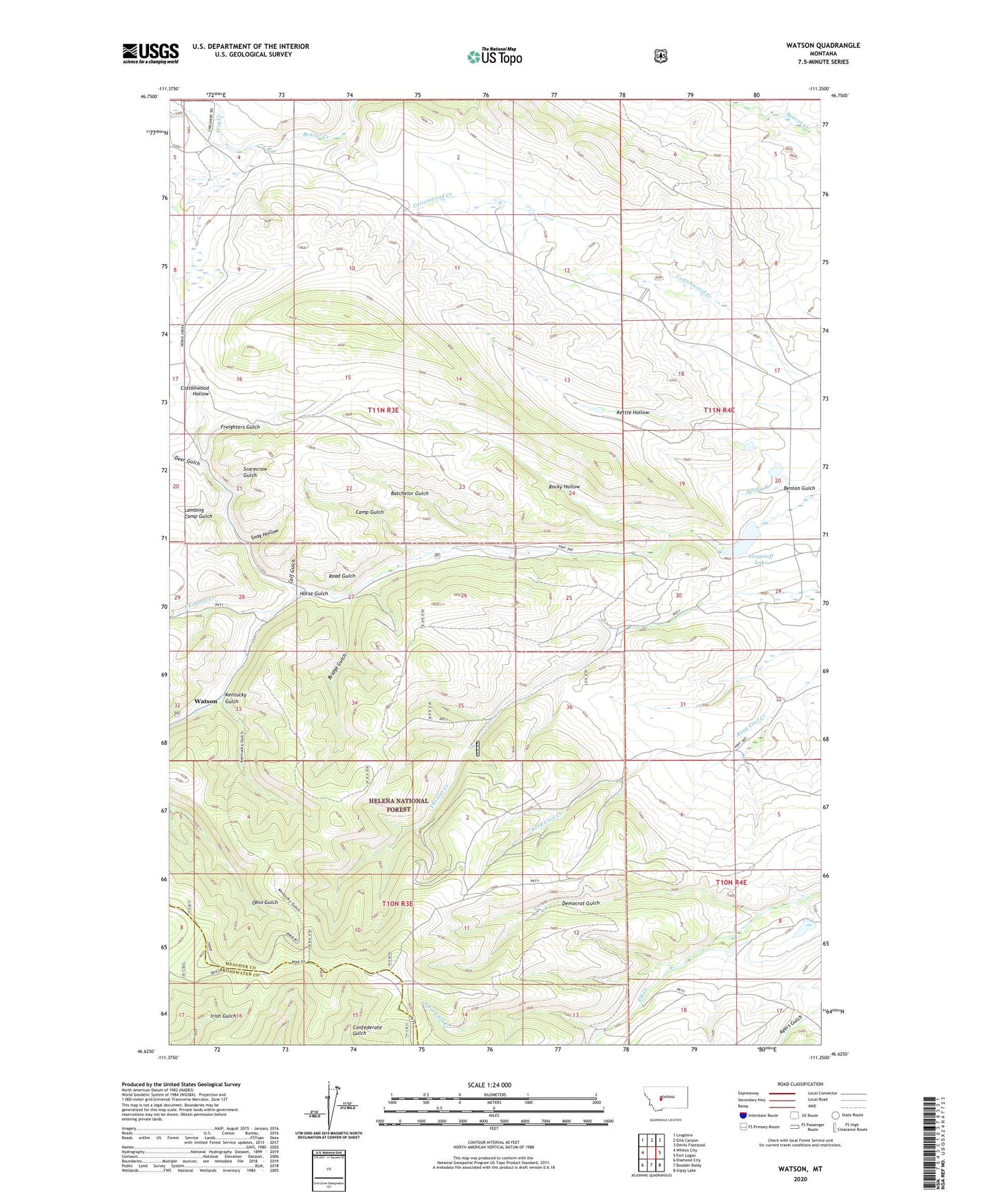
2020 topographic map quadrangle Watson in the state of Montana. Scale: 1:24000. Based on the newly updated USGS 7.5' US Topo map series, this map is in the following counties: Meagher, Broadwater. The map contains contour data, water features, and other items you are used to seeing on USGS maps, but also has updated roads and other features. This is the next generation of topographic maps. Printed on high-quality waterproof paper with UV fade-resistant inks.
Quads adjacent to this one:
West: Whites City
Northwest: Lingshire
North: Ellis Canyon
Northeast: Devils Footstool
East: Fort Logan
Southeast: Gipsy Lake
South: Boulder Baldy
Southwest: Diamond City
Contains the following named places: 11N03E28D___01 Well, Batchelor Gulch, Benton Gulch Guard Station, Bridge Gulch, Calf Gulch, Camp Gulch, Cottonwood Hollow, Deer Gulch, Democrat Gulch, Freighters Gulch, Horse Gulch, Kentucky Gulch, Kettle Hollow, Lambing Camp Gulch, North Fork Elk Creek, Preston, Road Gulch, Robin Hood Number 1 Dam, Robin Hood Number 2 Dam, Rocky Hollow, Roger Rader Dam, Scarecrow Gulch, Snag Hollow, Stoyanoff Dam, Stoyanoff Lake, Thomas Creek Mine, Vermont Creek, Vermont Creek Mine, Watson, Watson Post Office, Watson School, Wry Creek