MyTopo
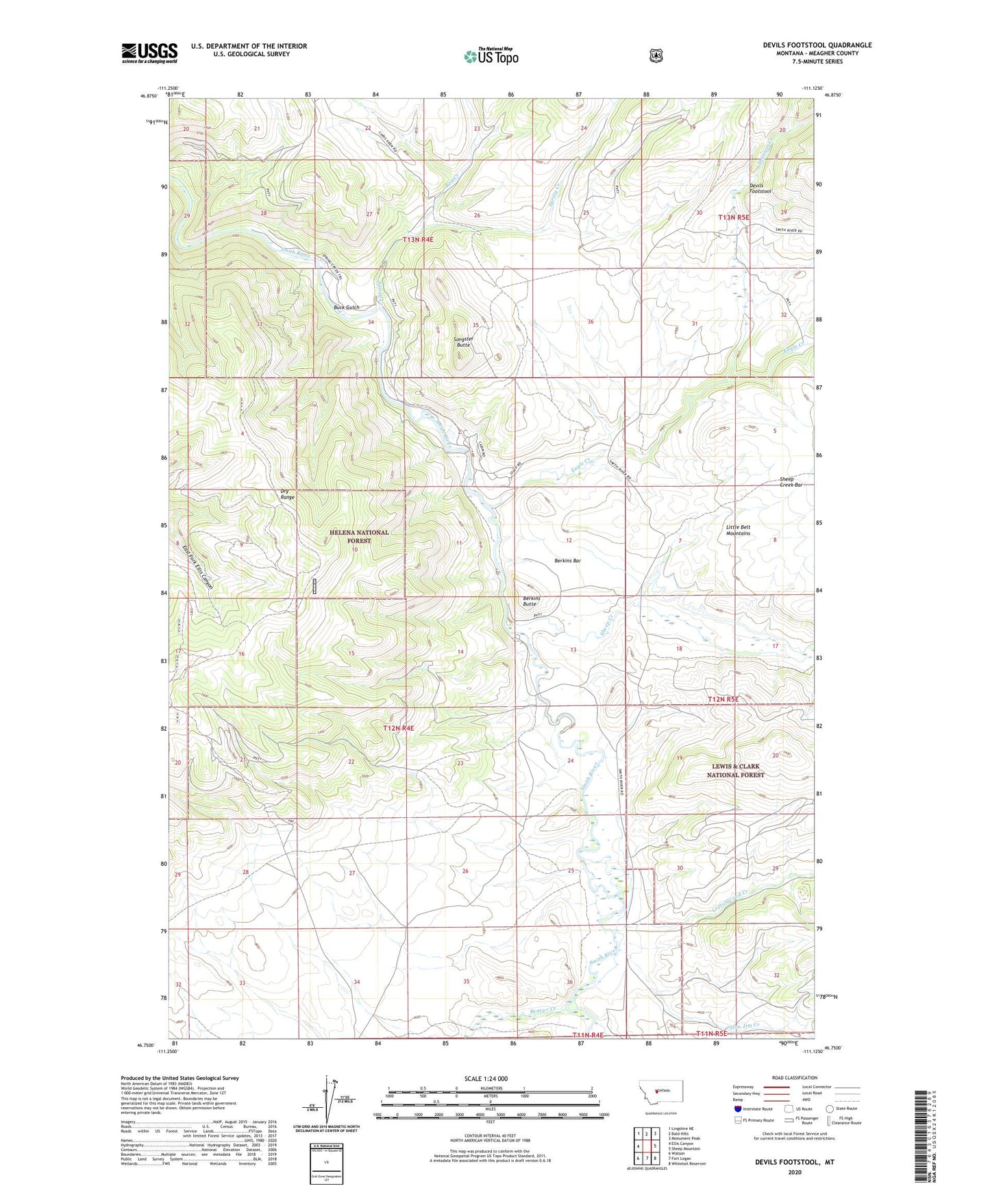
Devils Footstool Montana US Topo Map
Couldn't load pickup availability
Also explore the Devils Footstool Forest Service Topo of this same quad for updated USFS data
2024 topographic map quadrangle Devils Footstool in the state of Montana. Scale: 1:24000. Based on the newly updated USGS 7.5' US Topo map series, this map is in the following counties: Meagher. The map contains contour data, water features, and other items you are used to seeing on USGS maps, but also has updated roads and other features. This is the next generation of topographic maps. Printed on high-quality waterproof paper with UV fade-resistant inks.
Quads adjacent to this one:
West: Ellis Canyon
Northwest: Lingshire NE
North: Bald Hills
Northeast: Monument Peak
East: Sheep Mountain
Southeast: Whitetail Reservoir
South: Fort Logan
Southwest: Watson
This map covers the same area as the classic USGS quad with code o46111g2.
Contains the following named places: Beaver Creek, Berkins Bar, Berkins Butte, Buck Gulch, Camp Baker Recreation Site, Cottonwood Creek, Devils Footstool, Eagle Creek, Fort Baker Sportmans Access, Ray Creek, Shannon Creek, Sheep Creek, Slim Jim Creek, Songster Butte, Songster Butte Mine, Spring Creek, Whitetail Deer Creek