MyTopo
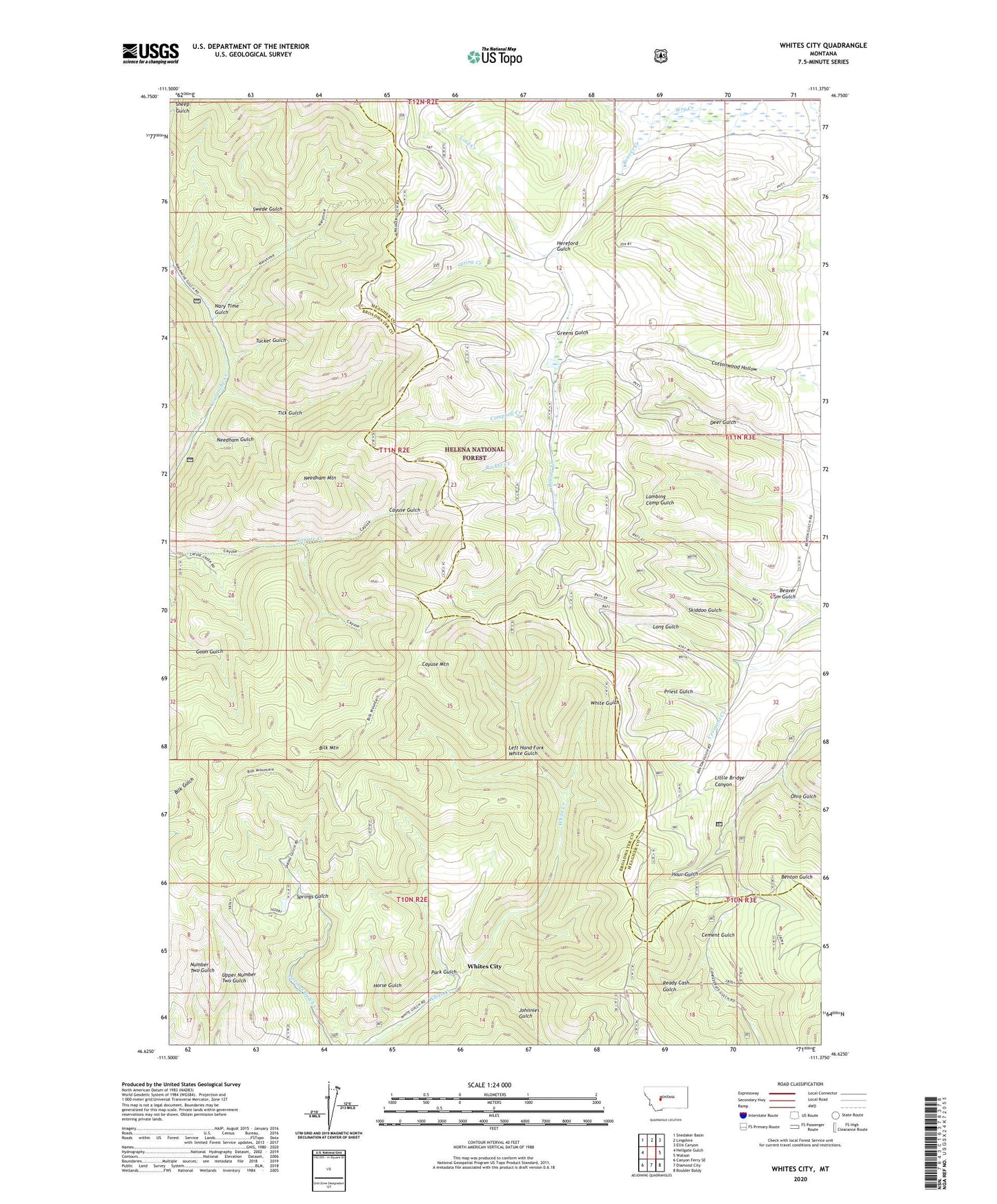
Whites City Montana US Topo Map
Couldn't load pickup availability
Also explore the Whites City Forest Service Topo of this same quad for updated USFS data
2024 topographic map quadrangle Whites City in the state of Montana. Scale: 1:24000. Based on the newly updated USGS 7.5' US Topo map series, this map is in the following counties: Broadwater, Meagher. The map contains contour data, water features, and other items you are used to seeing on USGS maps, but also has updated roads and other features. This is the next generation of topographic maps. Printed on high-quality waterproof paper with UV fade-resistant inks.
Quads adjacent to this one:
West: Hellgate Gulch
Northwest: Snedaker Basin
North: Lingshire
Northeast: Ellis Canyon
East: Watson
Southeast: Boulder Baldy
South: Diamond City
Southwest: Canyon Ferry SE
This map covers the same area as the classic USGS quad with code o46111f4.
Contains the following named places: Beaver Dam Gulch, Benton Gulch Mine, Bilk Mountain, Campbell Creek, Cayuse Mountain, Greens Gulch, Hereford Gulch, Horse Gulch, Hour Gulch, Humming Bird Mine, Hummingbird Mine, Johnnies Gulch, Left Hand Fork White Gulch, Lind Creek, Little Bridge Canyon, Long Gulch, Nary Time Gulch, Needham Gulch, Needham Gulch Mine, Needham Mountain, Ohio Gulch, Park Gulch, Priest Gulch, Ready Cash Gulch, Rocker Creek, Schabert Mine, SE SE Section 26 Mine, Skiddoo Gulch, Spring Creek, Swede Gulch, Thompson Creek, Tick Gulch, Tucker Gulch, Whites City, Whites Post Office