MyTopo
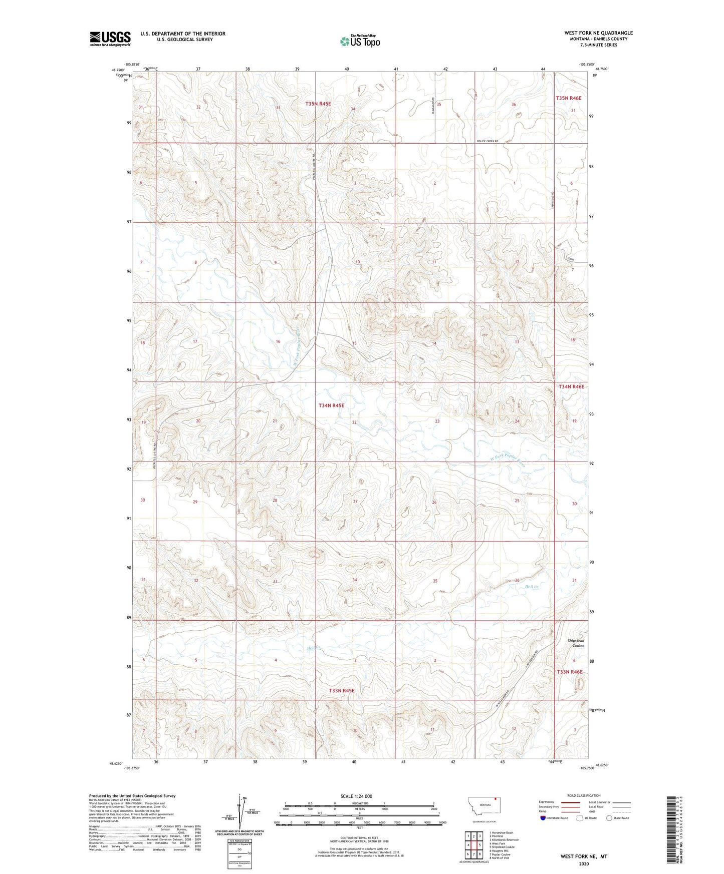
West Fork NE Montana US Topo Map
Couldn't load pickup availability
2024 topographic map quadrangle West Fork NE in the state of Montana. Scale: 1:24000. Based on the newly updated USGS 7.5' US Topo map series, this map is in the following counties: Daniels. The map contains contour data, water features, and other items you are used to seeing on USGS maps, but also has updated roads and other features. This is the next generation of topographic maps. Printed on high-quality waterproof paper with UV fade-resistant inks.
Quads adjacent to this one:
West: West Fork
Northwest: Horseshoe Basin
North: Peerless
Northeast: Killenbeck Reservoir
East: Shipstead Coulee
Southeast: North of Volt
South: Poplar Coulee
Southwest: Haugens Hill
This map covers the same area as the classic USGS quad with code o48105f7.
Contains the following named places: 34N45E01ADB_01 Well, 34N45E01DAAA01 Well, 34N45E01DAAD01 Well, 34N45E02CCCC01 Well, 34N45E04ADCD01 Well, 34N45E12BDCC01 Well, 35N45E34ACBD01 Well, 35N45E34CCAA01 Well, Hell Creek