MyTopo
Whately Montana US Topo Map
Couldn't load pickup availability
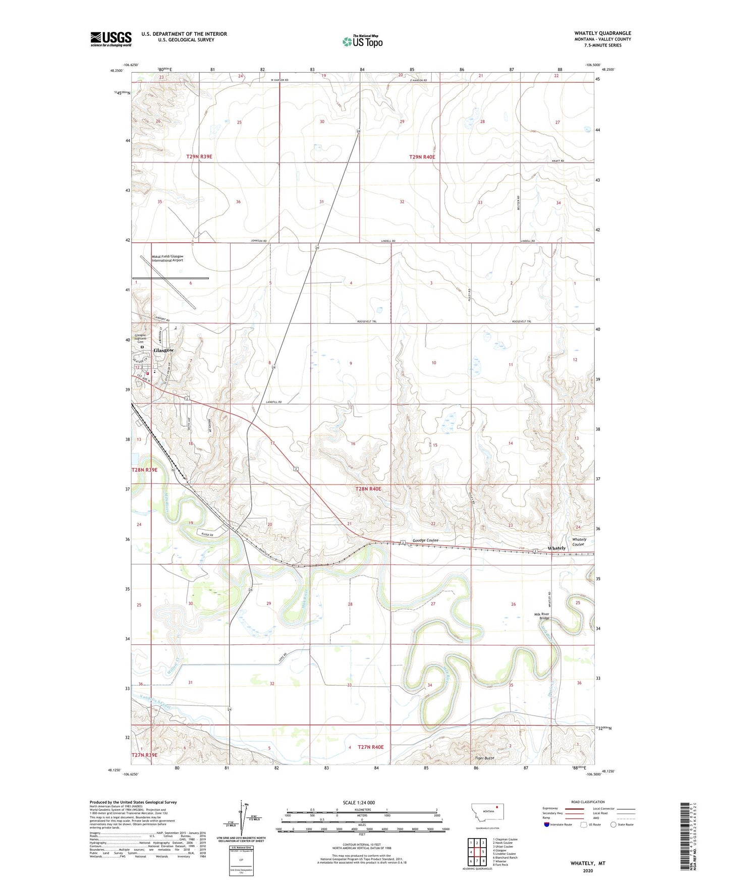
2020 topographic map quadrangle Whately in the state of Montana. Scale: 1:24000. Based on the newly updated USGS 7.5' US Topo map series, this map is in the following counties: Valley. The map contains contour data, water features, and other items you are used to seeing on USGS maps, but also has updated roads and other features. This is the next generation of topographic maps. Printed on high-quality waterproof paper with UV fade-resistant inks.
Quads adjacent to this one:
West: Glasgow
Northwest: Chapman Coulee
North: Hawk Coulee
Northeast: Uhlan Coulee
East: Lindeke Coulee
Southeast: Fort Peck
South: Wheeler
Southwest: Blanchard Ranch
Contains the following named places: 27N40E06CDCD01 Well, 28N40E15DDAB01 Well, 28N40E22CABC01 Well, 28N40E31CCBA01 Well, 28N40E31CCBD01 Well, 28N40E31CDCD01 Well, Centennial Park, Dogie Creek, Evangelical Church, Glasgow Army Air Field, Glasgow High School, Glasgow Highland Cemetery, Glasgow Middle School, Glasgow Stock Yards, Goudge Coulee, Hanson Dam, Joy Fellowship, Milk River Bridge, Reorganized Church of Jesus Christ of Latter Day Saints, Scottie Field, Shady Rest RV Park, Smith Clinic Park, Sullivan Park, Tiger Butte, Valley County Long Run Fire Department, Vandalia South Canal, Whately, Whately Coulee, Whately Post Office, Willow Creek