
MyTopo
Whiskey Coulee Montana US Topo Map
Couldn't load pickup availability
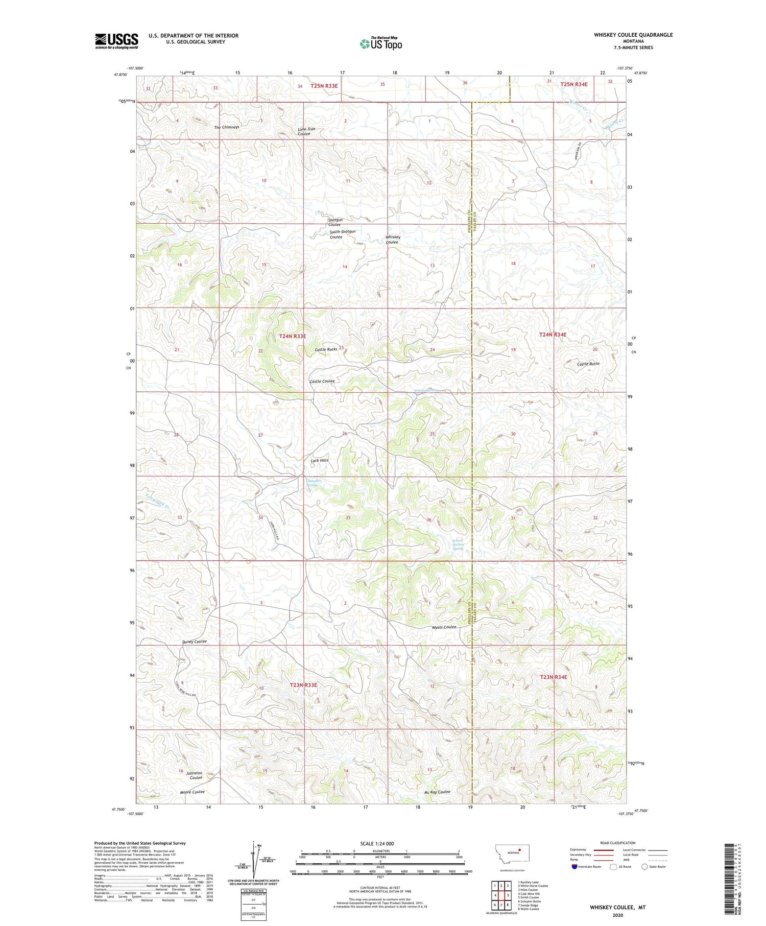
2020 topographic map quadrangle Whiskey Coulee in the state of Montana. Scale: 1:24000. Based on the newly updated USGS 7.5' US Topo map series, this map is in the following counties: Phillips, Valley. The map contains contour data, water features, and other items you are used to seeing on USGS maps, but also has updated roads and other features. This is the next generation of topographic maps. Printed on high-quality waterproof paper with UV fade-resistant inks.
Quads adjacent to this one:
West: Coal Mine Hill
Northwest: Buckley Lake
North: White Horse Coulee
Northeast: Niles Coulee
East: Smith Coulee
Southeast: Wolfe Coulee
South: Swede Ridge
Southwest: Schuyler Butte
Contains the following named places: 24N34E18AD__01 Well, Anderson Ranch, Castle Butte, Castle Rocks, Chandler Spring, Franks Spring, Mc Kay Coulee, North Shotgun Coulee, School Section Spring, Smith Ranch, South Shotgun Coulee, Square Creek, The Chimneys, Whiskey Coulee


