MyTopo
Smith Coulee Montana US Topo Map
Couldn't load pickup availability
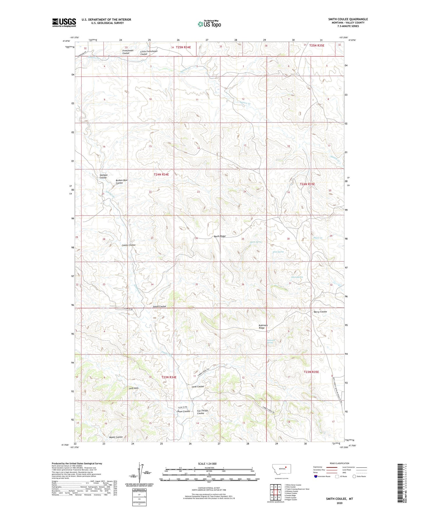
2024 topographic map quadrangle Smith Coulee in the state of Montana. Scale: 1:24000. Based on the newly updated USGS 7.5' US Topo map series, this map is in the following counties: Valley. The map contains contour data, water features, and other items you are used to seeing on USGS maps, but also has updated roads and other features. This is the next generation of topographic maps. Printed on high-quality waterproof paper with UV fade-resistant inks.
Quads adjacent to this one:
West: Whiskey Coulee
Northwest: White Horse Coulee
North: Niles Coulee
Northeast: Triple Crossing Reservoir West
East: Gibson Coulee
Southeast: Wagon Coulee
South: Wolfe Coulee
Southwest: Swede Ridge
This map covers the same area as the classic USGS quad with code o47107g3.
Contains the following named places: 23N34E14BDCA01 Well, 24N34E34CDBB01 Well, Barth Ridge, Barth Spring, Broken Bow Coulee, Castle Coulee, Cut Throat Coulee, Delight Post Office, Etchart Cow Camp, Frenchman Coulee, Kline Spring, Lena Coulee, Little Frenchman Coulee, Lone Pine School, Olson Spring, Plum Coulee, Robinson Ridge, Robinson Spring, Shotgun Coulee, Smith Coulee