MyTopo
Niles Coulee Montana US Topo Map
Couldn't load pickup availability
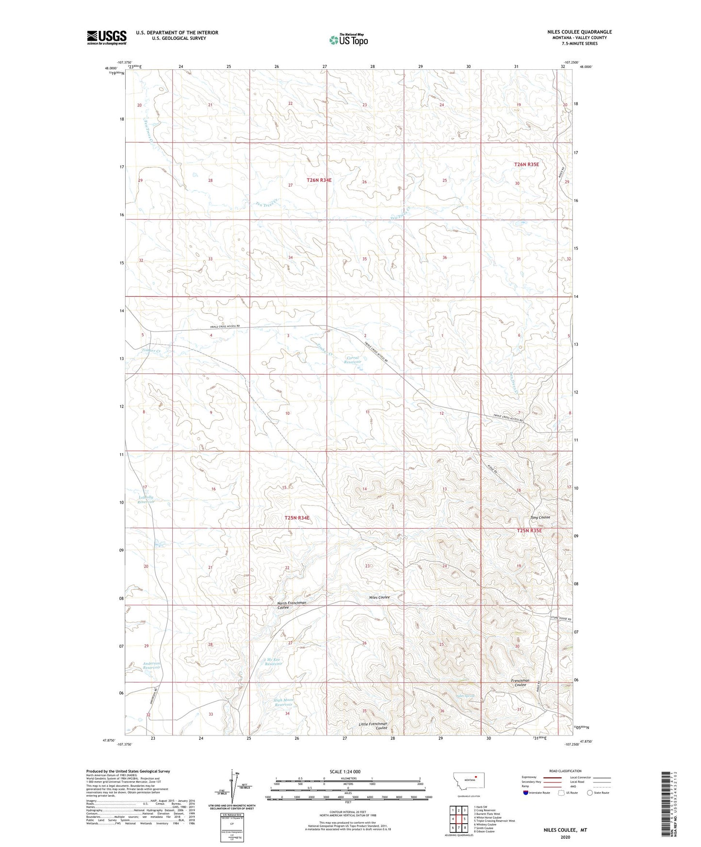
2024 topographic map quadrangle Niles Coulee in the state of Montana. Scale: 1:24000. Based on the newly updated USGS 7.5' US Topo map series, this map is in the following counties: Valley. The map contains contour data, water features, and other items you are used to seeing on USGS maps, but also has updated roads and other features. This is the next generation of topographic maps. Printed on high-quality waterproof paper with UV fade-resistant inks.
Quads adjacent to this one:
West: White Horse Coulee
Northwest: Harb SW
North: Craig Reservoir
Northeast: Burnett Flats West
East: Triple Crossing Reservoir West
Southeast: Gibson Coulee
South: Smith Coulee
Southwest: Whiskey Coulee
This map covers the same area as the classic USGS quad with code o47107h3.
Contains the following named places: Anderson Reservoir, Corral Reservoir, High Moon Reservoir, Loblolly Reservoir, Mc Kee Reservoir, Niles Coulee, Niles Spring, North Frenchman Coulee, Odin Dam