
MyTopo
Whitetail Montana US Topo Map
Couldn't load pickup availability
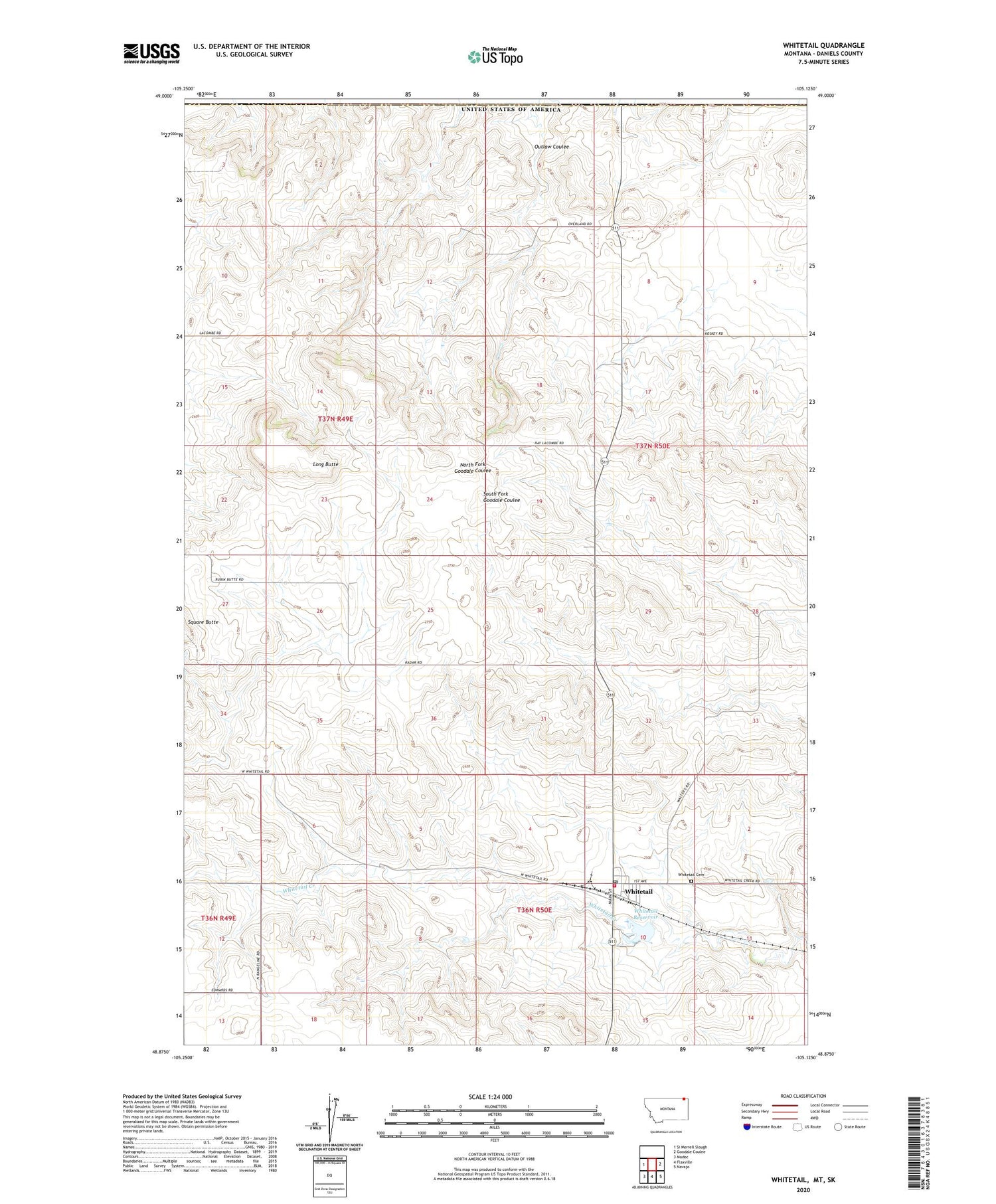
2020 topographic map quadrangle Whitetail in the state of Montana. Scale: 1:24000. Based on the newly updated USGS 7.5' US Topo map series, this map is in the following counties: Daniels. The map contains contour data, water features, and other items you are used to seeing on USGS maps, but also has updated roads and other features. This is the next generation of topographic maps. Printed on high-quality waterproof paper with UV fade-resistant inks.
Quads adjacent to this one:
West: Si Merrell Slough
East: Goodale Coulee
Southeast: Navajo
South: Flaxville
Southwest: Madoc
Contains the following named places: 36N49E01DCAC01 Well, 36N49E01DCAC02 Well, 36N49E12DCDC01 Well, 36N49E12DCDD01 Well, 36N50E03CBDD01 Well, 36N50E03CDDC01 Well, 36N50E03DDCC01 Well, 36N50E10BACA01 Well, 36N50E15BBAD01 Well, 37N49E01CADB01 Well, 37N49E01CCCC01 Well, 37N49E01CCCC02 Well, 37N49E03AADC01 Well, 37N49E11DCDA01 Well, 37N49E12AABB01 Well, 37N49E12ABAA01 Well, 37N49E13DBCB01 Well, 37N50E05BBAA01 Well, 37N50E17BABA01 Well, 37N50E18ADAA01 Well, 37N50E19DDDB01 Well, 59276, Hansen-Barzen Elevator, Hediger Dam, Long Butte, Outlaw Coulee, Port of Whitetail, Saint Thomas Catholic Church, Whitetail, Whitetail Baptist Church, Whitetail Cemetery, Whitetail Census Designated Place, Whitetail Community Church, Whitetail Dam, Whitetail Fire Department, Whitetail Grain Company Elevator, Whitetail Post Office, Whitetail Reservoir, Whitetail Reservoir Fishing Access Site, Whitetail School


