MyTopo
Willis Buttes Montana US Topo Map
Couldn't load pickup availability
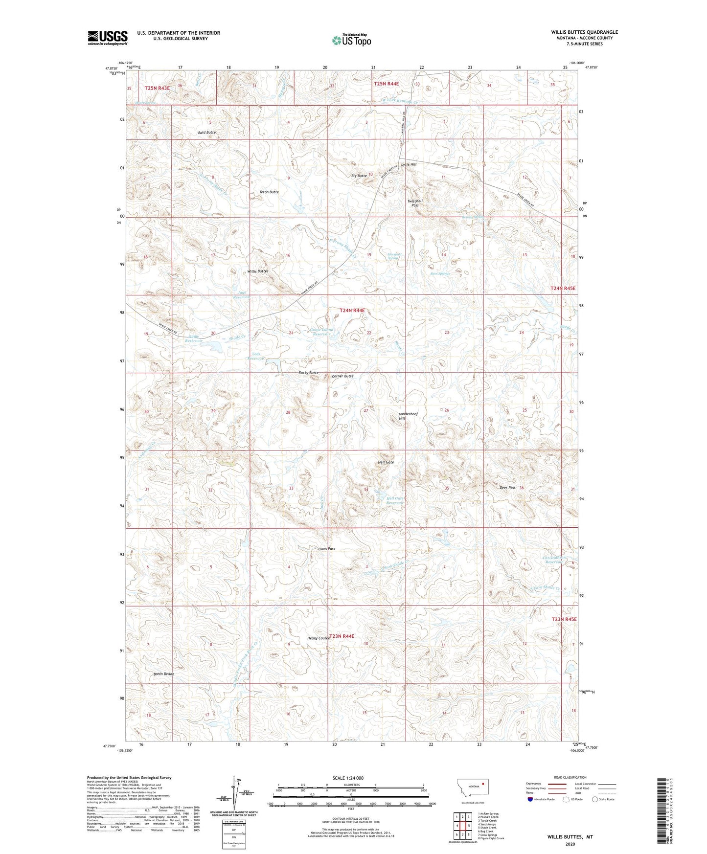
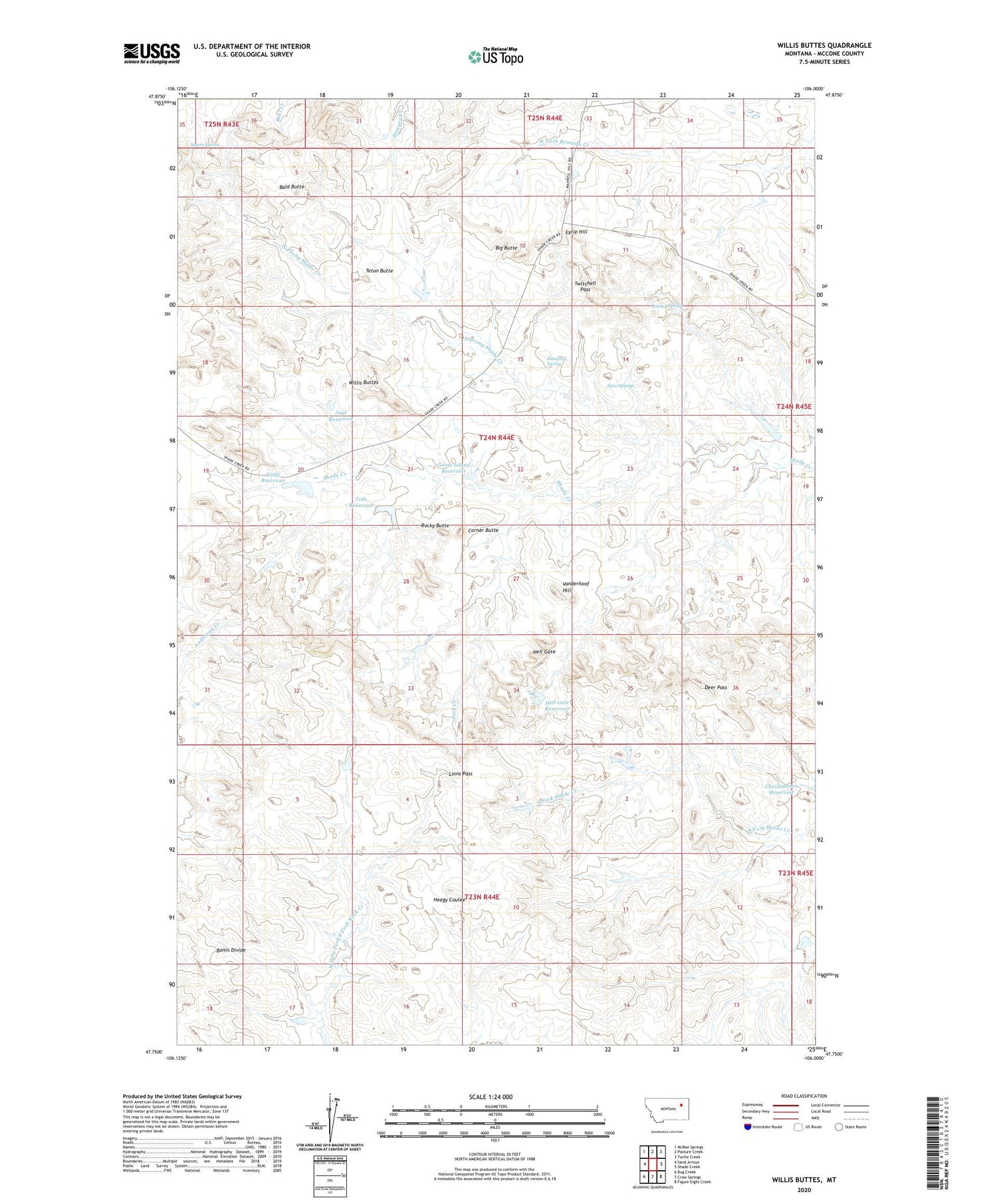
2020 topographic map quadrangle Willis Buttes in the state of Montana. Scale: 1:24000. Based on the newly updated USGS 7.5' US Topo map series, this map is in the following counties: McCone. The map contains contour data, water features, and other items you are used to seeing on USGS maps, but also has updated roads and other features. This is the next generation of topographic maps. Printed on high-quality waterproof paper with UV fade-resistant inks.
Quads adjacent to this one:
West: Sand Arroyo
Northwest: McRae Springs
North: Pasture Creek
Northeast: Turtle Creek
East: Shade Creek
Southeast: Figure Eight Creek
South: Crow Springs
Southwest: Bug Creek
Contains the following named places: 24N44E12DAAA01 Well, 24N44E20CABD01 Well, 24N44E21AACB01 Well, Alecs Springs, Bald Butte, Big Butte, Bonin Divide, Corner Butte, Deer Pass, Game Reservoir, Game Reservoir Dam, Goose Island Reservoir, Hell Gate, Hell Gate Reservoir, Hell Gate Reservoir Dam, Horsford Spring, Illmont School, Jack Creek, Jays Reservoir, Lions Pass, Lytle Hill, Margaret Hays Number 1 Dam, Moore Spring, North Dam, North Prong Shade Creek, Pattonhill Post Office, Rocky Butte, Rooney Spring, Shady Lane Dam, Teds Reservoir, Teds Reservoir Dam, Teton Butte, Twitchell Pass, US Number 1 Dam, Vanderhoof Hill, Walton Reservoir Dam, Willis Buttes