MyTopo
Bredette Montana US Topo Map
Couldn't load pickup availability
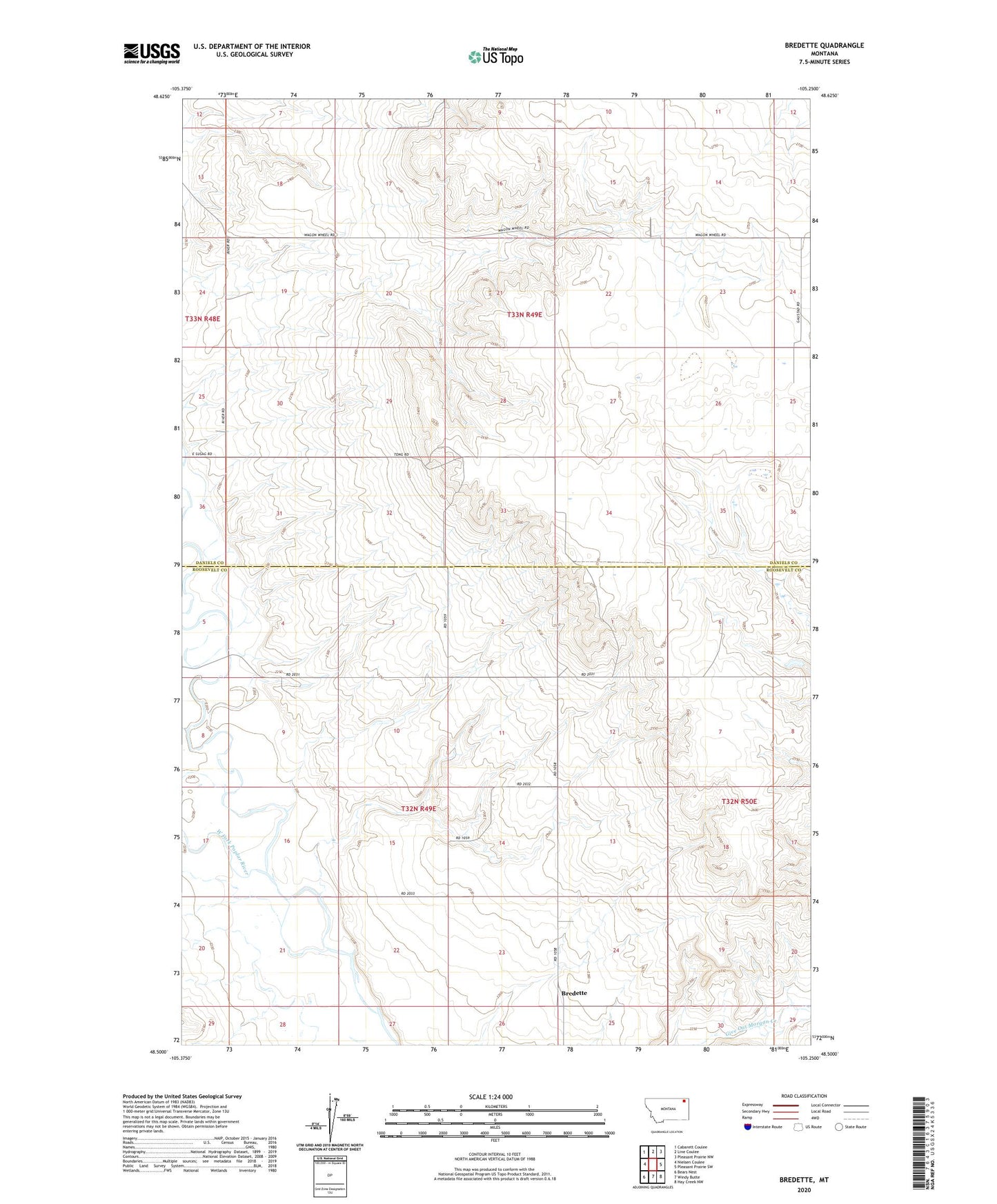
2024 topographic map quadrangle Bredette in the state of Montana. Scale: 1:24000. Based on the newly updated USGS 7.5' US Topo map series, this map is in the following counties: Roosevelt, Daniels. The map contains contour data, water features, and other items you are used to seeing on USGS maps, but also has updated roads and other features. This is the next generation of topographic maps. Printed on high-quality waterproof paper with UV fade-resistant inks.
Quads adjacent to this one:
West: Nielsen Coulee
Northwest: Cabarett Coulee
North: Line Coulee
Northeast: Pleasant Prairie NW
East: Pleasant Prairie SW
Southeast: Hay Creek NW
South: Windy Butte
Southwest: Bears Nest
This map covers the same area as the classic USGS quad with code o48105e3.
Contains the following named places: 32N49E13DA__01 Well, 32N49E15CDCC01 Well, 32N50E19BC__01 Well, 33N49E15DDBA01 Well, 33N49E24CCDA01 Well, 33N49E24CCDC01 Well, 33N49E26DAAA01 Well, 33N49E34CB__01 Well, Bredette, Bredette Post Office, Bredette School, Stentoft Dam, West Fork Poplar River