MyTopo
Woody Mountain NW Montana US Topo Map
Couldn't load pickup availability
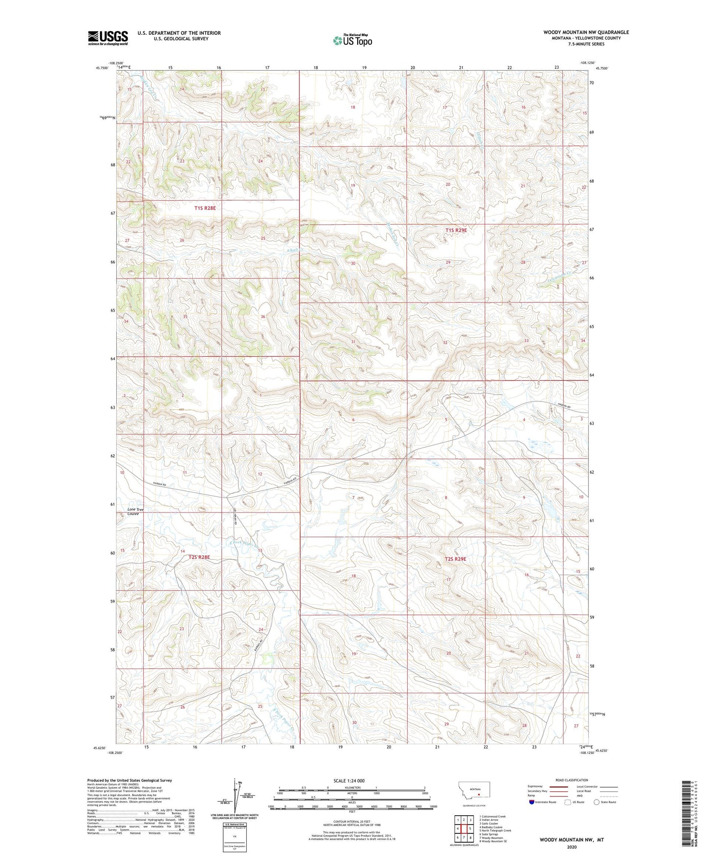
2024 topographic map quadrangle Woody Mountain NW in the state of Montana. Scale: 1:24000. Based on the newly updated USGS 7.5' US Topo map series, this map is in the following counties: Yellowstone. The map contains contour data, water features, and other items you are used to seeing on USGS maps, but also has updated roads and other features. This is the next generation of topographic maps. Printed on high-quality waterproof paper with UV fade-resistant inks.
Quads adjacent to this one:
West: Badbaby Coulee
Northwest: Cottonwood Creek
North: Indian Arrow
Northeast: Gails Coulee
East: North Telegraph Creek
Southeast: Woody Mountain SE
South: Woody Mountain
Southwest: Soda Springs
This map covers the same area as the classic USGS quad with code o45108f2.
Contains the following named places: 02S28E24DCCD01 Well, 02S29E04BACC01 Well, 02S29E05DDCD01 Well, 02S29E17BC__01 Well, Crow Number 75 Dam, Crow Number 77 Dam, Crow Number 79 Dam, Crow Number 80 Dam, Doctor Lee Number 2 Dam, Jr Scott Number 18 Dam, KKUL-FM (Hardin), KOUS-TV (Hardin), Lone Tree Coulee