MyTopo
Zero Montana US Topo Map
Couldn't load pickup availability
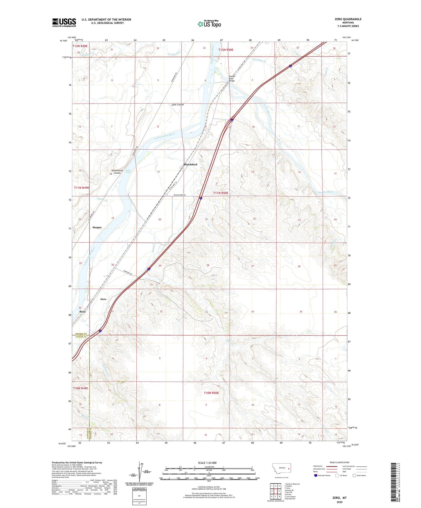
2020 topographic map quadrangle Zero in the state of Montana. Scale: 1:24000. Based on the newly updated USGS 7.5' US Topo map series, this map is in the following counties: Prairie, Custer. The map contains contour data, water features, and other items you are used to seeing on USGS maps, but also has updated roads and other features. This is the next generation of topographic maps. Printed on high-quality waterproof paper with UV fade-resistant inks.
Quads adjacent to this one:
West: Kinsey NE
Northwest: McClure Reservoir
North: Calypso
Northeast: Terry
East: Zero NE
Southeast: Spring Draw
South: Corral Butte
Southwest: Shirley
Contains the following named places: 10N50E03BBDD01 Well, 11N49E24DAAD01 Well, 11N49E25ADBA01 Well, 11N50E03BC__01 Well, 11N50E05ADBD01 Well, 11N50E08DD__01 Well, 11N50E12BC__01 Well, 11N50E20DC__01 Well, 11N50E32ADDD01 Well, 11N50E32CD__01 Well, Baker Rapids, Batchelor Creek, Blatchford, Calypso School, Camp Creek, Clear View School, Custer Creek, Dan Number 2 Dam, Foley, Foley Post Office, Garfield Post Office, Gate Coulee, McQuiod Creek, North Fork Crooked Creek, Powder Post Office, Powder River, Powder River Bridge, Powder River Depot Fishing Access Site, Powder River Historical Marker, Powder River Station, Saugus, Saugus Post Office, Saugus School, Susan, Terrys Supply Camp, Townsend Stage Station, Yellowstone Coulee, Zero, Zero Post Office, Zero School