MyTopo
Alexandria Nebraska US Topo Map
Couldn't load pickup availability
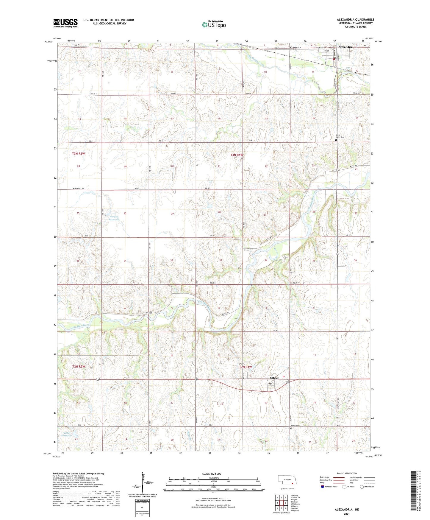
2021 topographic map quadrangle Alexandria in the state of Nebraska. Scale: 1:24000. Based on the newly updated USGS 7.5' US Topo map series, this map is in the following counties: Thayer. The map contains contour data, water features, and other items you are used to seeing on USGS maps, but also has updated roads and other features. This is the next generation of topographic maps. Printed on high-quality waterproof paper with UV fade-resistant inks.
Quads adjacent to this one:
West: Hebron
Northwest: Bruning
North: Tobias SW
Northeast: Daykin
East: Gladstone
Southeast: Reynolds
South: Hubbell
Southwest: Chester
Contains the following named places: Alexandria, Alexandria Cemetery, Alexandria Election Precinct, Alexandria Post Office, Alexandria Public School, Alexandria Rescue Unit, Alexandria United Presbyterian Church, Alexandria Volunteer Fire Department, Bradshaw School, Bruning Grain and Feed Company Elevator, Fischer Dam, Fischer Reservoir, Flowery Dale School, Gilead, Gilead Election Precinct, Gilead Post Office - CPO, Gilead Public School, Gilead Volunteer Fire Department, Hergott Dam, Hergott Reservoir, Knape School, Meridian State Wildlife Management Area, Norder Agri-Grain Incorporated Elevator, Pleasant Mound School, Saint Mary Catholic Church, Saint Marys Cemetery, Sandy Knob School, Township of Alexandria, Township of Gilead, Tucker Memorial Library, Union Cemetery, Village of Alexandria, Village of Gilead, ZIP Code: 68362