MyTopo
Reynolds Nebraska US Topo Map
Couldn't load pickup availability
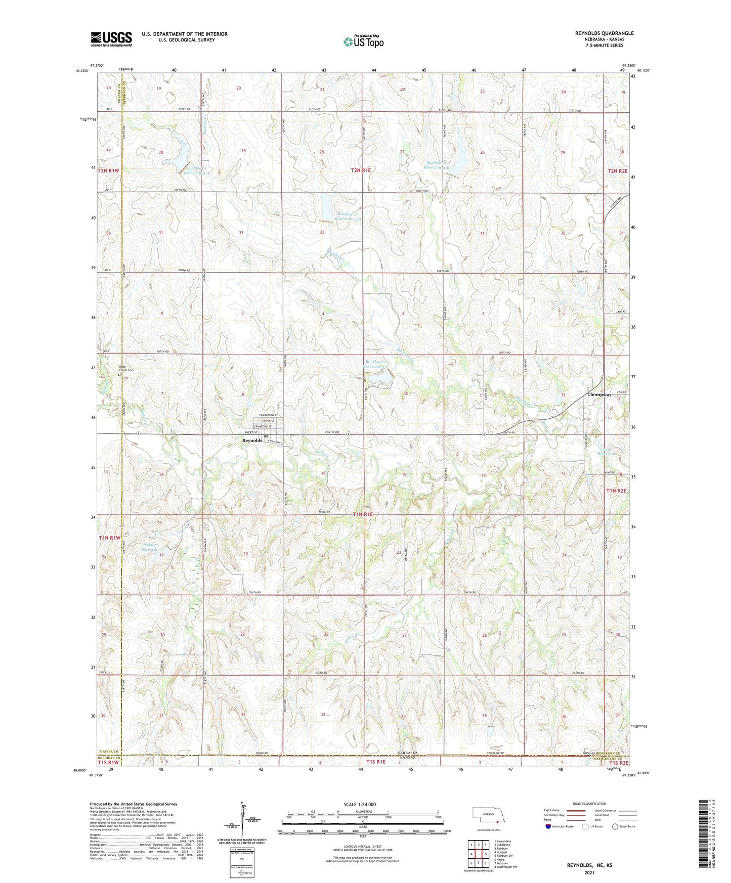
2021 topographic map quadrangle Reynolds in the state of Nebraska. Scale: 1:24000. Based on the newly updated USGS 7.5' US Topo map series, this map is in the following counties: Jefferson, Thayer, Washington, Republic. The map contains contour data, water features, and other items you are used to seeing on USGS maps, but also has updated roads and other features. This is the next generation of topographic maps. Printed on high-quality waterproof paper with UV fade-resistant inks.
Quads adjacent to this one:
West: Hubbell
Northwest: Alexandria
North: Gladstone
Northeast: Fairbury
East: Fairbury SW
Southeast: Washington NW
South: Mahaska
Southwest: Narka
This map covers the same area as the classic USGS quad with code o40097a3.
Contains the following named places: Balls Branch, Buckley Creek, Buckley Creek Reservoir 3-A, Buckley Creek Reservoir 3-D, Buckley Creek Reservoir 3-F, Buckley Creek Reservoir 4-B, Buckley Election Precinct, Buckley State Rectreation Area, Detention Dam 3-D, Detention Dam 4-B, Floodwater Retarding Dam 3-A, Floodwater Retarding Dam 3-F, Hein Dam, Hein Reservoir, Old Rogers School, Priefert Dam, Priefert Reservoir, Reynolds, Reynolds Post Office - CPO, Rose Creek Cemetery, School Number 26, School Number 28, Thompson, Thompson Post Office, Township of Buckley, United Grain Elevator, Village of Reynolds, Wiley Creek