MyTopo
Chester Nebraska US Topo Map
Couldn't load pickup availability
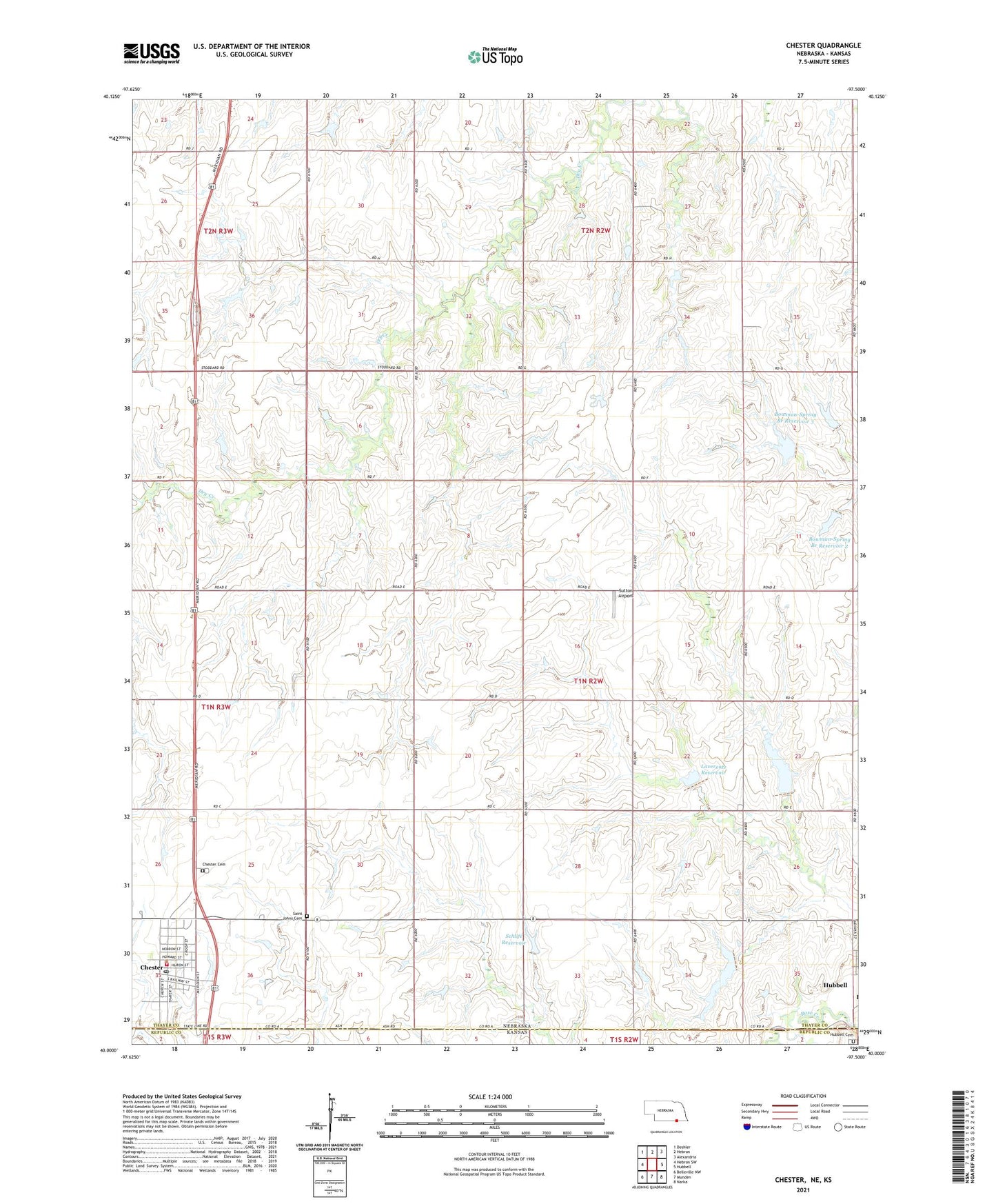
2021 topographic map quadrangle Chester in the states of Nebraska, Kansas. Scale: 1:24000. Based on the newly updated USGS 7.5' US Topo map series, this map is in the following counties: Thayer, Republic. The map contains contour data, water features, and other items you are used to seeing on USGS maps, but also has updated roads and other features. This is the next generation of topographic maps. Printed on high-quality waterproof paper with UV fade-resistant inks.
Quads adjacent to this one:
West: Hebron SW
Northwest: Deshler
North: Hebron
Northeast: Alexandria
East: Hubbell
Southeast: Narka
South: Munden
Southwest: Belleville NW
This map covers the same area as the classic USGS quad with code o40097a5.
Contains the following named places: Bowman-Spring Branch Dam 1-A, Bowman-Spring Branch Dam 1-B, Bowman-Spring Branch Dam 1-C, Bowman-Spring Branch Dam 3-C, Bowman-Spring Branch Dam 3-D, Bowman-Spring Branch Dam 3-E, Bowman-Spring Branch Reservoir 3, Chester, Chester Cemetery, Chester City Park, Chester City Park Campground, Chester Election Precinct, Chester Medical Clinic, Chester Post Office, Chester Public Library, Chester Volunteer Ambulance and Rescue Service, Chester Volunteer Fire Department, Chester-Hubbell-Byron Schools, Chester-Stoddard Election Precinct, Citizen Grain Company Elevator, Community Bible Church, Easton Field, Forrell School, Hubbell Cemetery, Laverentz Reservoir, Liberty Ridge School, Loyalty School, Miller Reservoir, Mount Zion School, Mumm Reservoir, Pleasant Ridge School, Saint John Lutheran Church, Saint Johns Cemetery, Saint Johns Lutheran Parochial School, Schlife Dam, Schlife Reservoir, Stoddard, Stoddard Post Office, Stoddard School II, Sutton Airport, Sylvan View School, Township of Chester, Township of Hubbell, United Methodist Church, Village of Chester, ZIP Code: 68327