MyTopo
Hubbell Nebraska US Topo Map
Couldn't load pickup availability
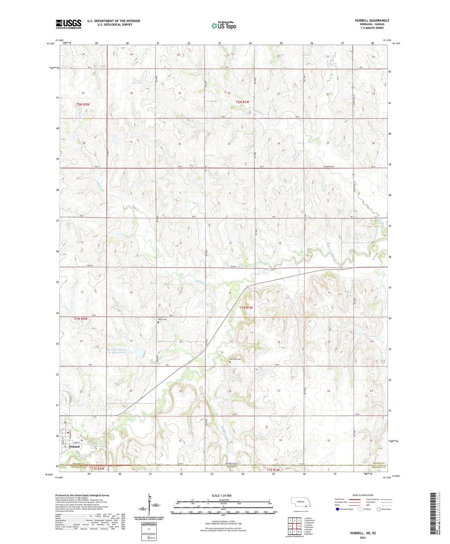
2021 topographic map quadrangle Hubbell in the state of Nebraska. Scale: 1:24000. Based on the newly updated USGS 7.5' US Topo map series, this map is in the following counties: Thayer, Republic. The map contains contour data, water features, and other items you are used to seeing on USGS maps, but also has updated roads and other features. This is the next generation of topographic maps. Printed on high-quality waterproof paper with UV fade-resistant inks.
Quads adjacent to this one:
West: Chester
Northwest: Hebron
North: Alexandria
Northeast: Gladstone
East: Reynolds
Southeast: Mahaska
South: Narka
Southwest: Munden
This map covers the same area as the classic USGS quad with code o40097a4.
Contains the following named places: Balls Branch, Bartling School, Bowman-Spring Branch Dam 2-A, Bowman-Spring Branch Reservoir 2, Boyd School, Hobbs School, Hubbell, Hubbell Post Office, Hubbell Rural Fire Protection District 11, Hubbell School, Hubbell-Rose Creek Election Precinct, Humphrey Branch, Lamb School, Prairie Chapel School, Saint Pauls Cemetery, Saint Pauls Church, Spring Branch, Toad Valley School, Township of Rose Creek, Union School, Village of Hubbell, Williams, Williams Cemetery, Williams Post Office, ZIP Code: 68375