MyTopo
Anselmo Nebraska US Topo Map
Couldn't load pickup availability
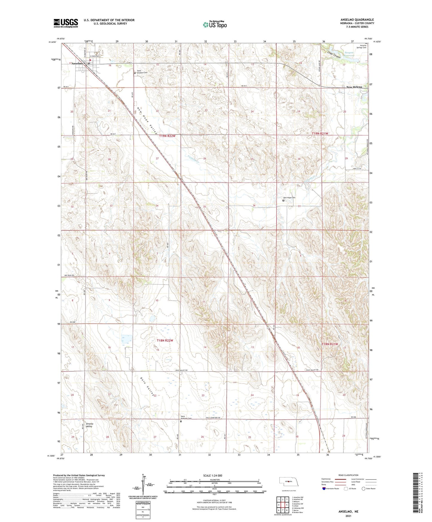
2021 topographic map quadrangle Anselmo in the state of Nebraska. Scale: 1:24000. Based on the newly updated USGS 7.5' US Topo map series, this map is in the following counties: Custer. The map contains contour data, water features, and other items you are used to seeing on USGS maps, but also has updated roads and other features. This is the next generation of topographic maps. Printed on high-quality waterproof paper with UV fade-resistant inks.
Quads adjacent to this one:
West: Anselmo SW
Northwest: Anselmo NW
North: Anselmo NE
Northeast: Milburn
East: Lillian
Southeast: Broken Bow
South: Merna
Southwest: Callaway NW
This map covers the same area as the classic USGS quad with code o41099e7.
Contains the following named places: Anselmo, Anselmo Post Office, Anselmo Volunteer Fire Department, Dale, Dale Post Office, Dale School, Karnes School, Keota Post Office, Keota School, Maroney School, New Helena, New Helena Post Office, New Helena School, New Hope Cemetery, New Hope Valley, Open Bible Standard Church, Saint Andrews Cemetery, Saint Anselms Catholic Church, Saint Anselms Cemetery, Sargent Dam, Sargent Reservoir, State of Nebraska, Victora Springs State Park, Village of Anselmo, ZIP Code: 68856