MyTopo
Westerville Nebraska US Topo Map
Couldn't load pickup availability
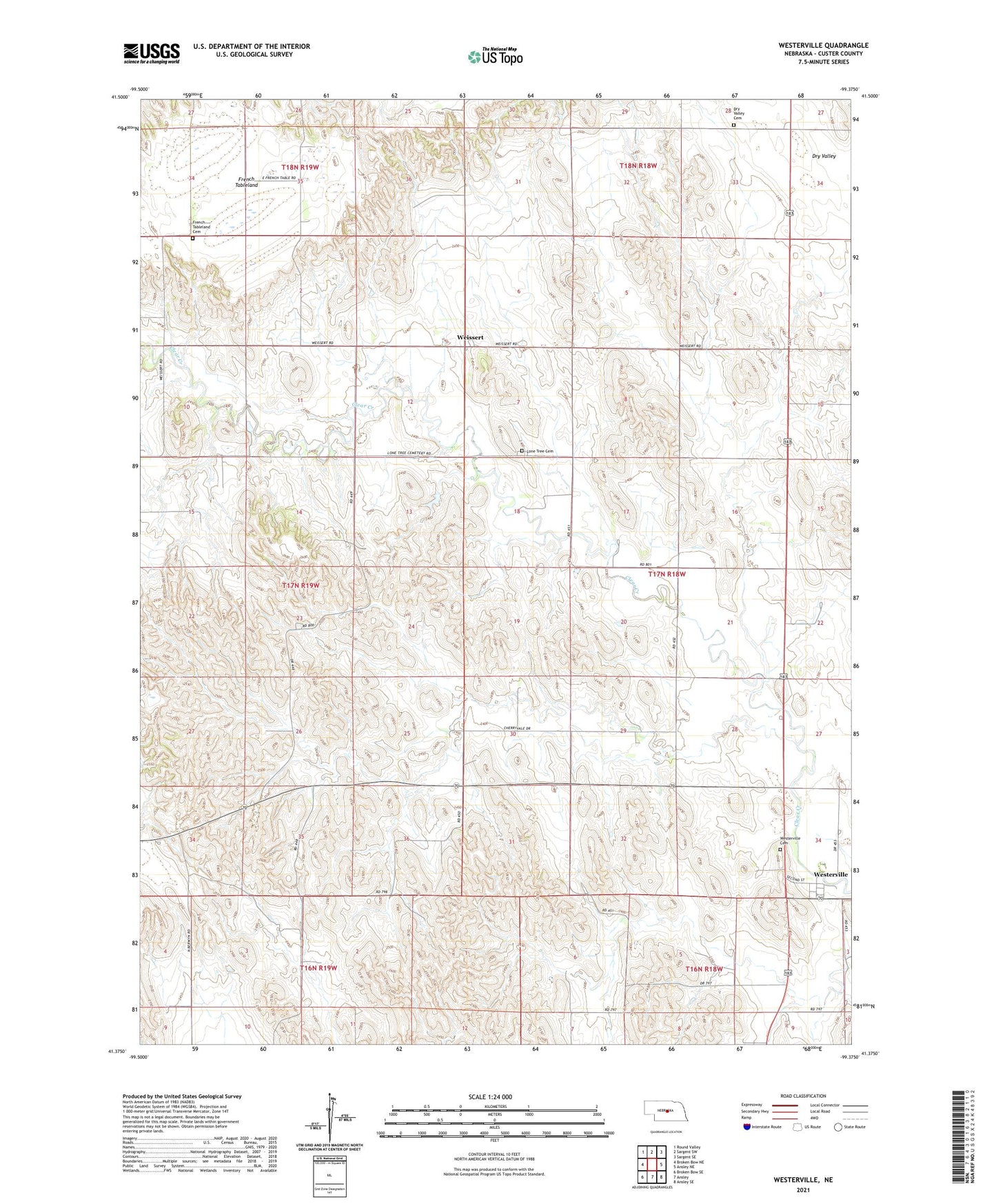
2021 topographic map quadrangle Westerville in the state of Nebraska. Scale: 1:24000. Based on the newly updated USGS 7.5' US Topo map series, this map is in the following counties: Custer. The map contains contour data, water features, and other items you are used to seeing on USGS maps, but also has updated roads and other features. This is the next generation of topographic maps. Printed on high-quality waterproof paper with UV fade-resistant inks.
Quads adjacent to this one:
West: Broken Bow NE
Northwest: Round Valley
North: Sargent SW
Northeast: Sargent SE
East: Ansley NE
Southeast: Ansley SE
South: Ansley
Southwest: Broken Bow SE
This map covers the same area as the classic USGS quad with code o41099d4.
Contains the following named places: Allen School, Cherryvale School, Copsey School, Dry Valley Cemetery, Dry Valley School, French Tableland, French Tableland Cemetery, Hanna Corners School, Lone Tree Cemetery, Lone Tree School, Pederson Ranch, Township of Westerville, United Methodist Church, Weissert, Weissert Church of God, Weissert Post Office, Weissert School, Westerville, Westerville Cemetery, Westerville Census Designated Place, Westerville Historical Marker, Westerville Post Office, Westerville School