MyTopo
McCarthy Lake Nebraska US Topo Map
Couldn't load pickup availability
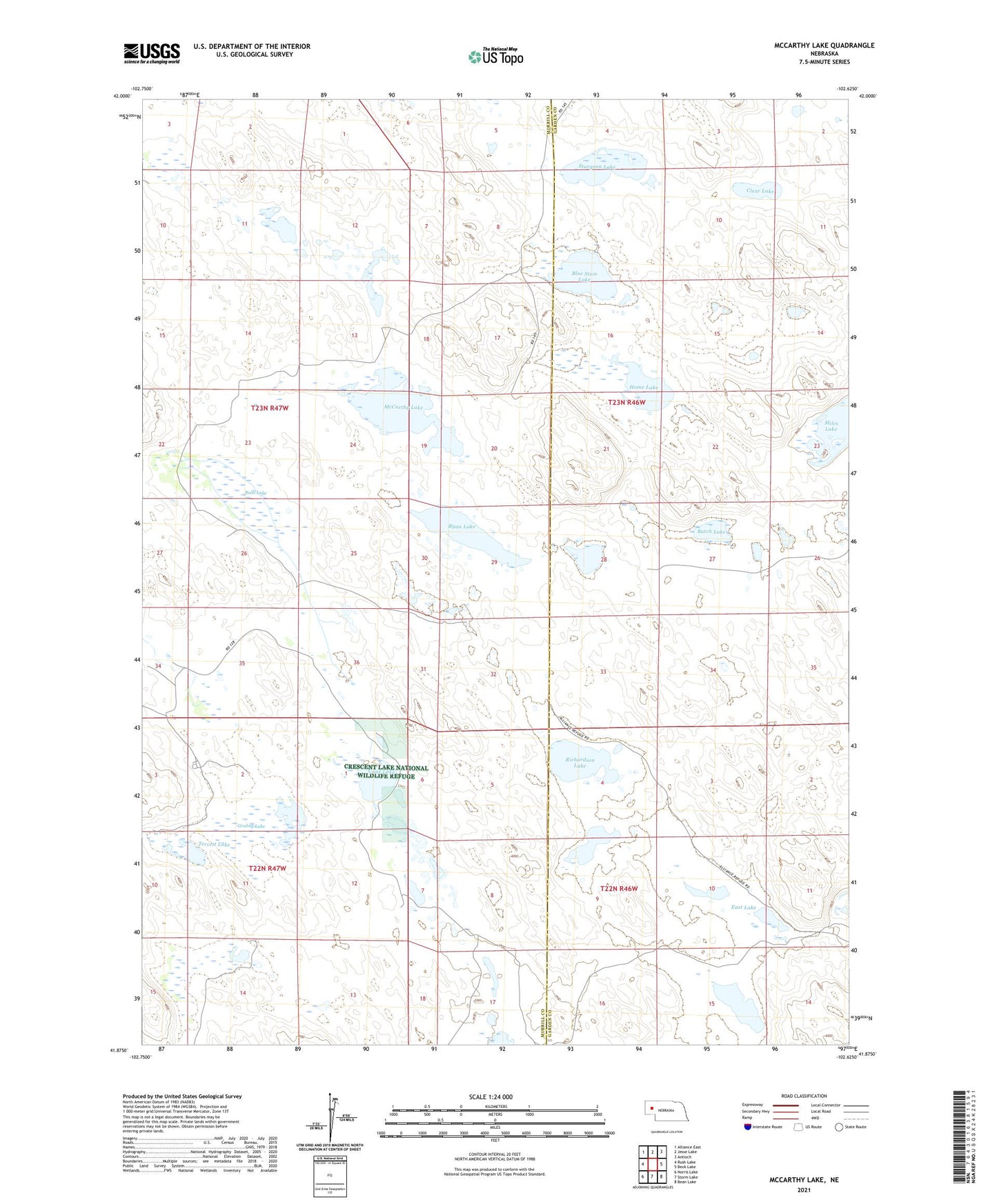
2021 topographic map quadrangle McCarthy Lake in the state of Nebraska. Scale: 1:24000. Based on the newly updated USGS 7.5' US Topo map series, this map is in the following counties: Morrill, Garden. The map contains contour data, water features, and other items you are used to seeing on USGS maps, but also has updated roads and other features. This is the next generation of topographic maps. Printed on high-quality waterproof paper with UV fade-resistant inks.
Quads adjacent to this one:
West: Rush Lake
Northwest: Alliance East
North: Jesse Lake
Northeast: Antioch
East: Beck Lake
Southeast: Bean Lake
South: Storm Lake
Southwest: Norris Lake
This map covers the same area as the classic USGS quad with code o41102h6.
Contains the following named places: Blue Stem Lake, Butch Lake, Cane Lake, Clear Lake, East Lake, Grubny Lake, Hague Ranch, Home Lake, Home Valley Lake, Johnson Lake, Kooper Ranch, McCarthy Lake, Nelson J Ranch, Nine Over Nine Ranch, Richardson Lake, Rush Lake, Ryan Lake, Skala Ranch, Sturgeon Lake, Tercett Lake, Thompson Ranch, Witners Ranch