
MyTopo
Arlington Nebraska US Topo Map
Couldn't load pickup availability
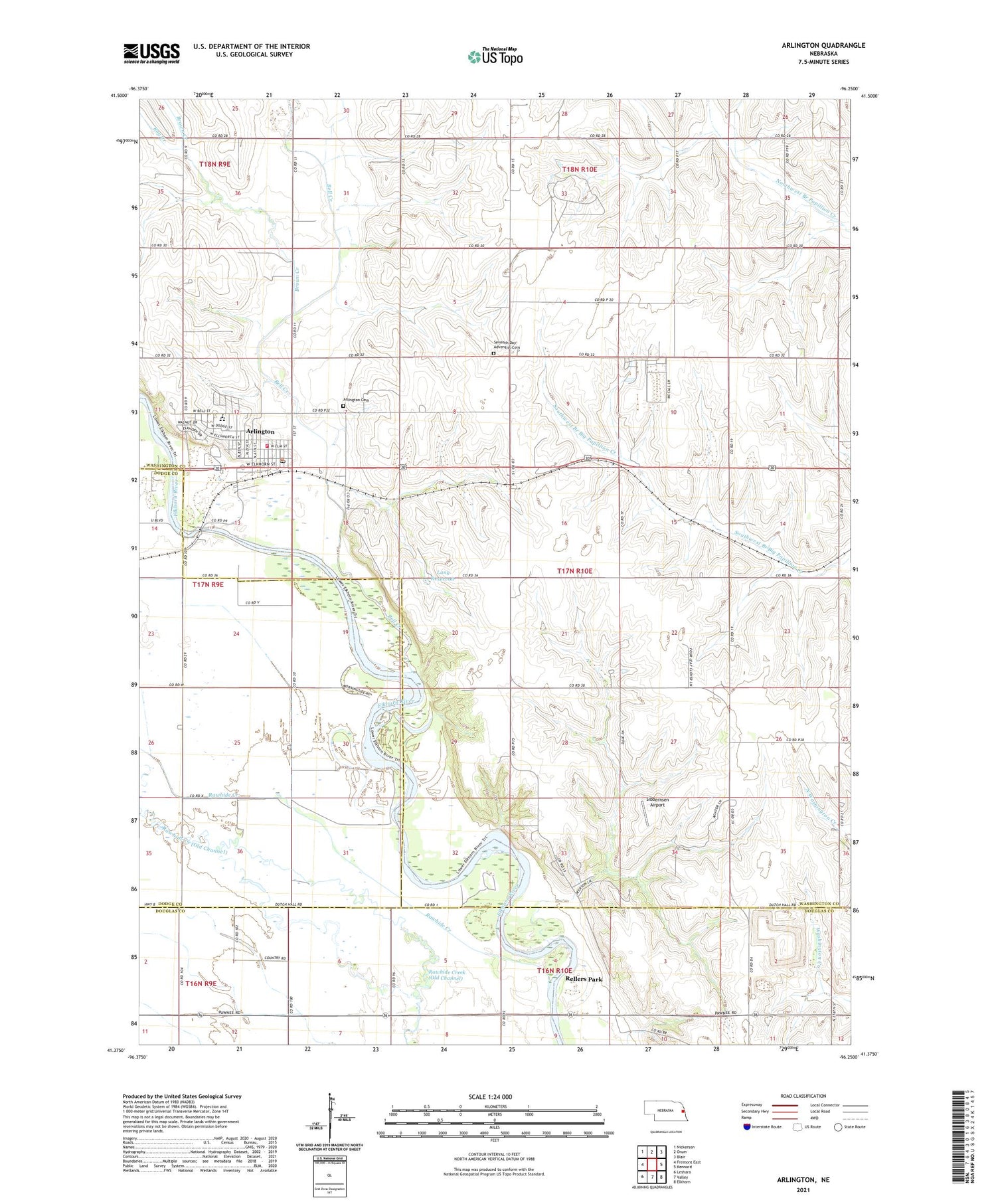
2021 topographic map quadrangle Arlington in the state of Nebraska. Scale: 1:24000. Based on the newly updated USGS 7.5' US Topo map series, this map is in the following counties: Washington, Douglas, Dodge. The map contains contour data, water features, and other items you are used to seeing on USGS maps, but also has updated roads and other features. This is the next generation of topographic maps. Printed on high-quality waterproof paper with UV fade-resistant inks.
Quads adjacent to this one:
West: Fremont East
Northwest: Nickerson
North: Orum
Northeast: Blair
East: Kennard
Southeast: Elkhorn
South: Valley
Southwest: Leshara
Contains the following named places: Arlington, Arlington Cemetery, Arlington Community Church, Arlington Elementary School, Arlington Family Dentistry, Arlington High School, Arlington Post Office, Arlington Public Library, Arlington Volunteer Fire Department, Bell Creek, Brown Creek, Dunklau Dairy, Lang Dam, Lang Reservoir, Ray Creek, Rellers Park, School Number 3, Seventh Day Adventist Cemetery, Sibbernsen Airport, Startown School, Township 7, Village of Arlington, Washington County Fair Grounds, ZIP Code: 68002


