MyTopo
Nickerson Nebraska US Topo Map
Couldn't load pickup availability
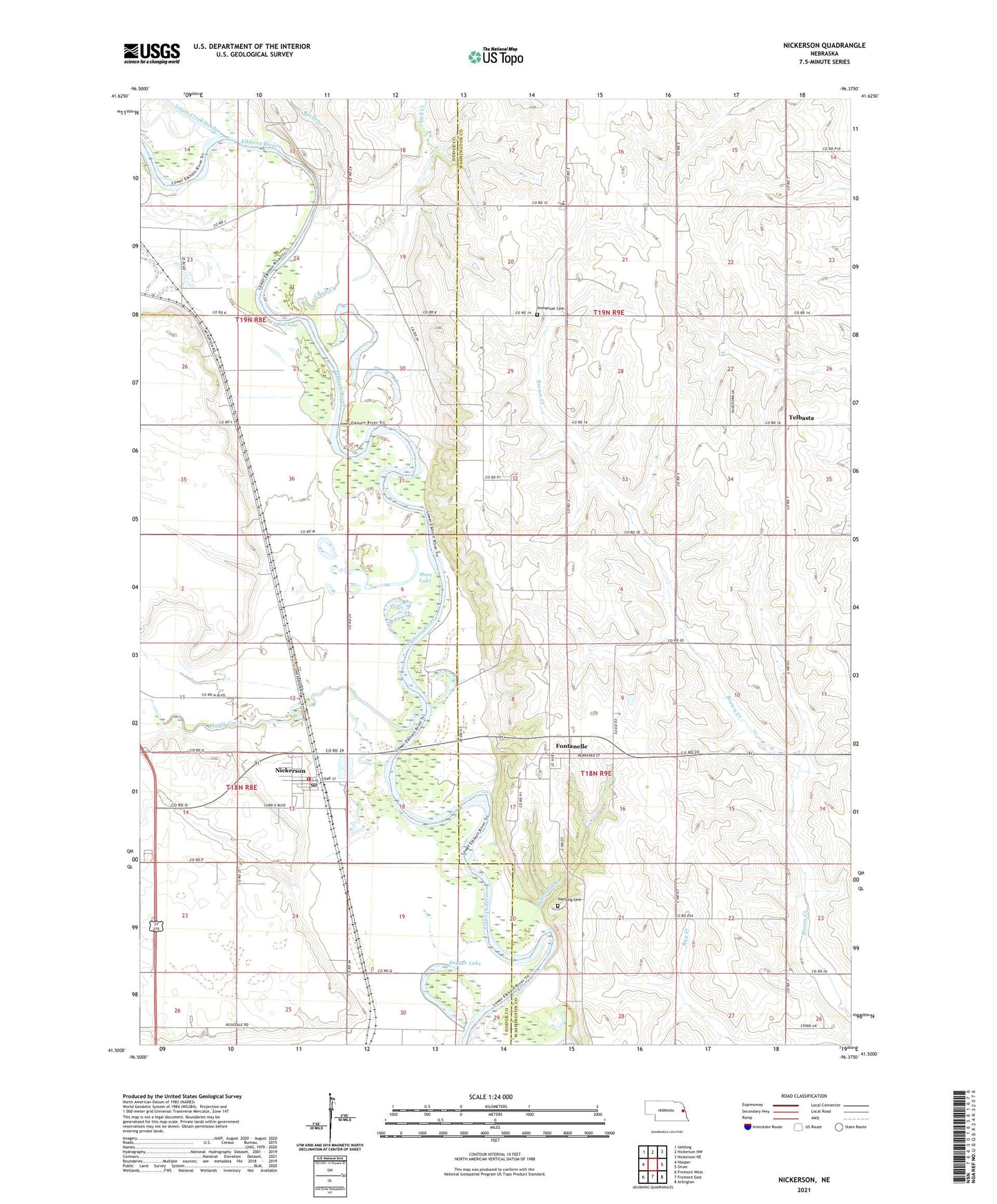
2021 topographic map quadrangle Nickerson in the state of Nebraska. Scale: 1:24000. Based on the newly updated USGS 7.5' US Topo map series, this map is in the following counties: Dodge, Washington. The map contains contour data, water features, and other items you are used to seeing on USGS maps, but also has updated roads and other features. This is the next generation of topographic maps. Printed on high-quality waterproof paper with UV fade-resistant inks.
Quads adjacent to this one:
West: Hooper
Northwest: Uehling
North: Nickerson NW
Northeast: Nickerson NE
East: Orum
Southeast: Arlington
South: Fremont East
Southwest: Fremont West
This map covers the same area as the classic USGS quad with code o41096e4.
Contains the following named places: Bachelor Creek, Buttermilk Creek, Camp Fontanelle, Clark Creek, Cross Arrows Camp, Elkhorn Valley Cooperative Company Elevator, Fish Lake, Fontanelle, Fontanelle Census Designated Place, Fontanelle Post Office, Hartung Cemetery, Immanuel Cemetery, Immanuel Church, Immanuel School, Maple Creek, Moss Lake, Nickerson, Nickerson Post Office, Nickerson Public School, Nickerson Volunteer Fire and Rescue, Rosedale Public School, Salem Church, Snyder Lake, Telbasta, Telbasta Post Office, Telbasta School, Township of Nickerson, Village of Nickerson, ZIP Code: 68044