MyTopo
Bean Lake Nebraska US Topo Map
Couldn't load pickup availability
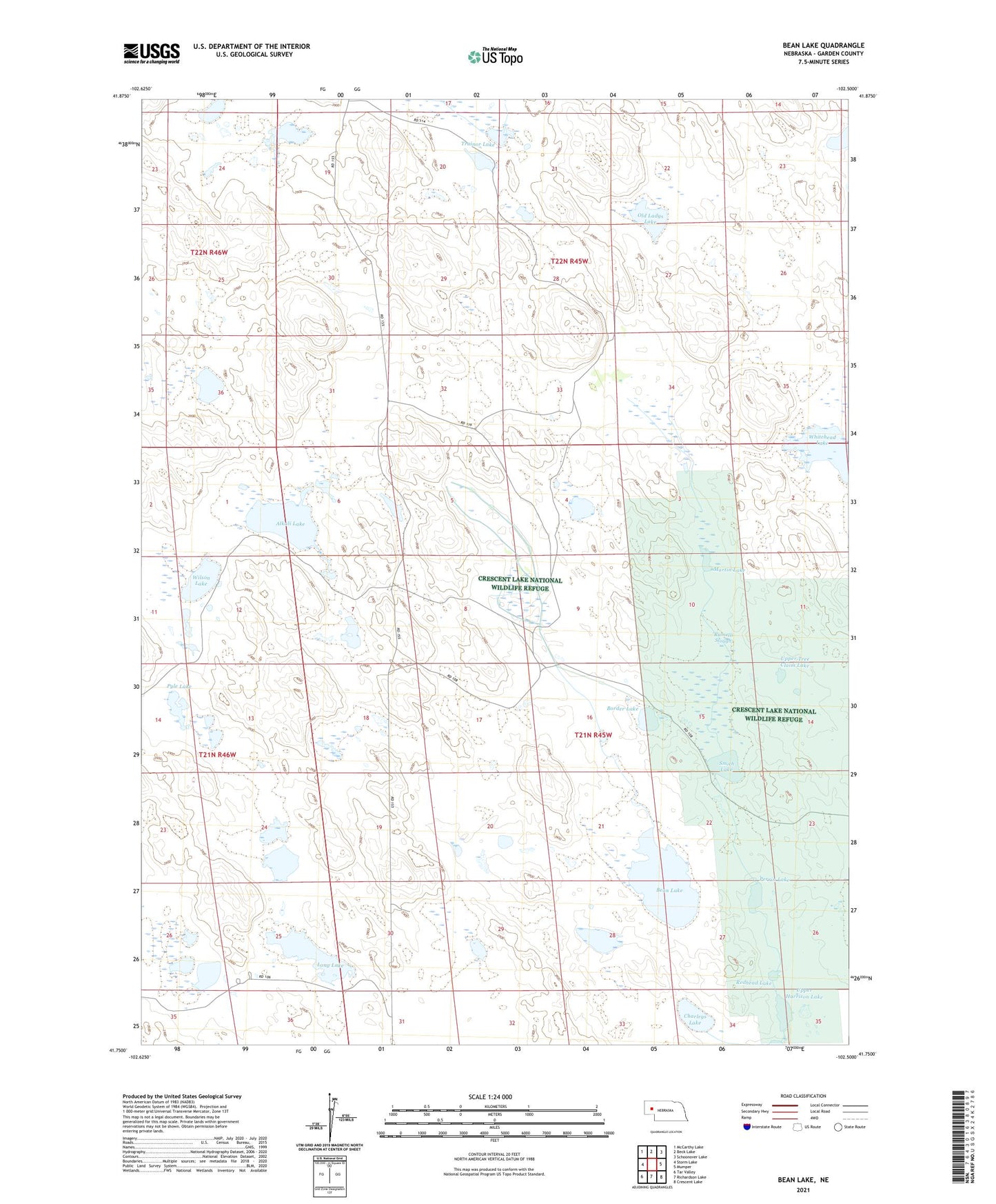
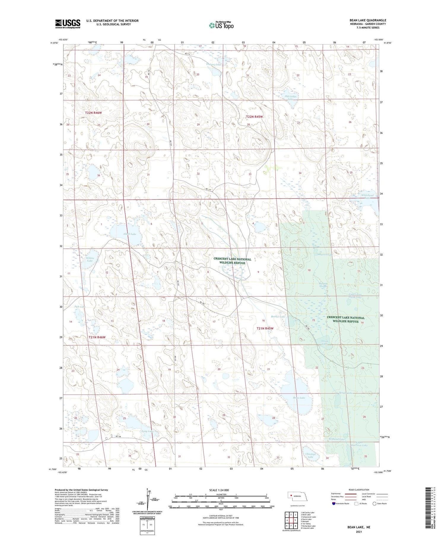
2021 topographic map quadrangle Bean Lake in the state of Nebraska. Scale: 1:24000. Based on the newly updated USGS 7.5' US Topo map series, this map is in the following counties: Garden. The map contains contour data, water features, and other items you are used to seeing on USGS maps, but also has updated roads and other features. This is the next generation of topographic maps. Printed on high-quality waterproof paper with UV fade-resistant inks.
Quads adjacent to this one:
West: Storm Lake
Northwest: McCarthy Lake
North: Beck Lake
Northeast: Schoonover Lake
East: Mumper
Southeast: Crescent Lake
South: Richardson Lake
Southwest: Tar Valley
Contains the following named places: Alkali Lake, Avery Ranch, Bean Lake, Border Lake, Charleys Lake, Drain Ranch, Eldred Lake, Eldred Ranch, Long Lake, M Peterson Ranch, Martin Lake, Meyer Lakes, Old Ladys Lake, Perrin Lake, Pyle Lake, Ramelli Slough, Redhead Lake, Smith Lake, Trainor Lake, Upper Harrison Lake, Upper Tree Claim Lake, Whitehead Lake, Wilson Lake