
MyTopo
Bear Hill Nebraska US Topo Map
Couldn't load pickup availability
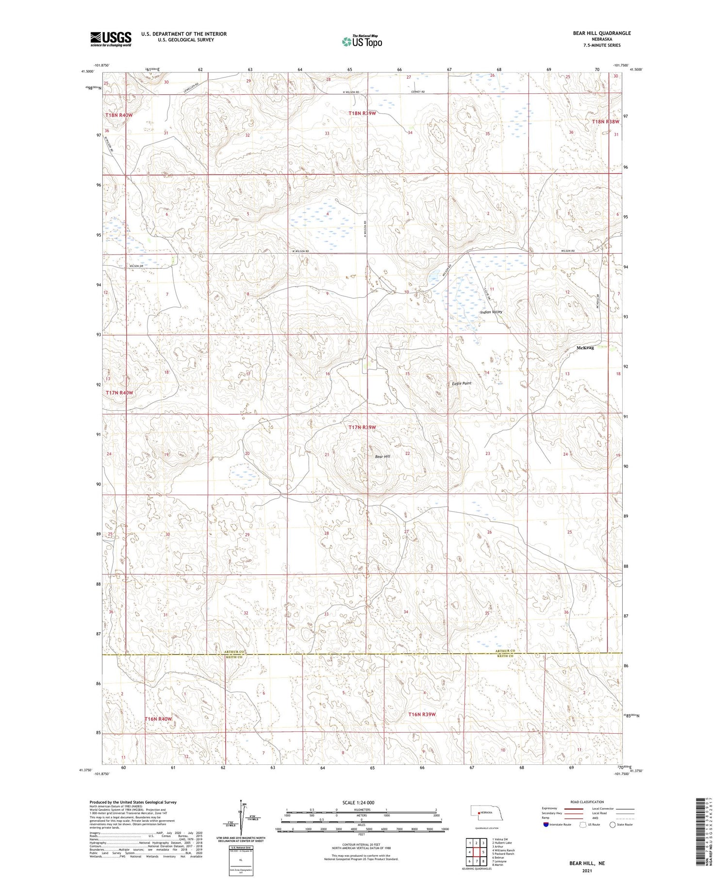
2021 topographic map quadrangle Bear Hill in the state of Nebraska. Scale: 1:24000. Based on the newly updated USGS 7.5' US Topo map series, this map is in the following counties: Arthur, Keith. The map contains contour data, water features, and other items you are used to seeing on USGS maps, but also has updated roads and other features. This is the next generation of topographic maps. Printed on high-quality waterproof paper with UV fade-resistant inks.
Quads adjacent to this one:
West: Williams Ranch
Northwest: Velma SW
North: Hulbert Lake
Northeast: Arthur
East: Packard Ranch
Southeast: Martin
South: Lemoyne
Southwest: Belmar
Contains the following named places: Bear Hill, Beeken Ranch, Cerny Ranch, Eagle Point, Enfield Ranch, Hazen Ranch, Indian Valley, McKeag, Wilson Ranch


