MyTopo
Lemoyne Nebraska US Topo Map
Couldn't load pickup availability
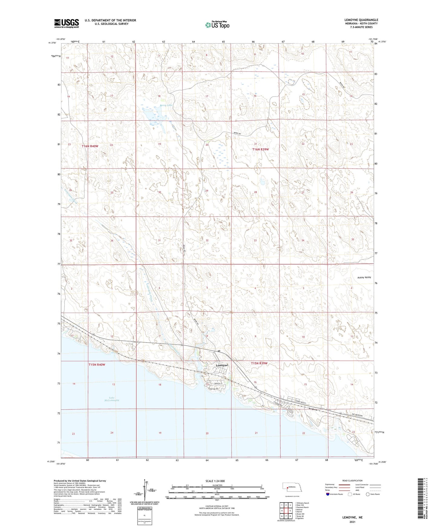
2021 topographic map quadrangle Lemoyne in the state of Nebraska. Scale: 1:24000. Based on the newly updated USGS 7.5' US Topo map series, this map is in the following counties: Keith. The map contains contour data, water features, and other items you are used to seeing on USGS maps, but also has updated roads and other features. This is the next generation of topographic maps. Printed on high-quality waterproof paper with UV fade-resistant inks.
Quads adjacent to this one:
West: Belmar
Northwest: Williams Ranch
North: Bear Hill
Northeast: Packard Ranch
East: Martin
Southeast: Ogallala
South: Brule NE
Southwest: Brule NW
This map covers the same area as the classic USGS quad with code o41101c7.
Contains the following named places: Admirals Cove Resort, Baumann Ranch, Berry Lake, Berry Ranch, Lake McConaughy State Recreation Area, Lemoyne, Lemoyne Campground, Lemoyne Census Designated Place, Lemoyne Mobile Home Park, Lemoyne Post Office, Lemoyne Public School, Lonergan Creek, North Shore Campground, North Shore Lodge, Sand Creek Campground, Sandy Beach Campground, Spring Park Campground, United Presbyterian Church, ZIP Code: 69146