MyTopo
Packard Ranch Nebraska US Topo Map
Couldn't load pickup availability
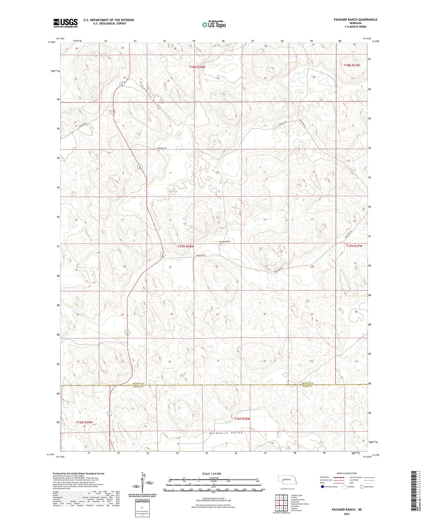
2021 topographic map quadrangle Packard Ranch in the state of Nebraska. Scale: 1:24000. Based on the newly updated USGS 7.5' US Topo map series, this map is in the following counties: Arthur, Keith. The map contains contour data, water features, and other items you are used to seeing on USGS maps, but also has updated roads and other features. This is the next generation of topographic maps. Printed on high-quality waterproof paper with UV fade-resistant inks.
Quads adjacent to this one:
West: Bear Hill
Northwest: Hulbert Lake
North: Arthur
Northeast: Lightning Valley
East: Spotted Horse Valley
Southeast: Glinn Ranch
South: Martin
Southwest: Lemoyne
This map covers the same area as the classic USGS quad with code o41101d6.
Contains the following named places: Dale Corfield Ranch, Erie Corfield Ranch, Fejt Ranch, Graham Ranch, Larsen Ranch, Packard Ranch, Packard Ranch Airport, Peterson Crouse Ranch, Peterson Ranch, Powers Ranch, School Number 4, Thoelecke Valley, Wildhorse Valley