MyTopo
Bertrand Nebraska US Topo Map
Couldn't load pickup availability
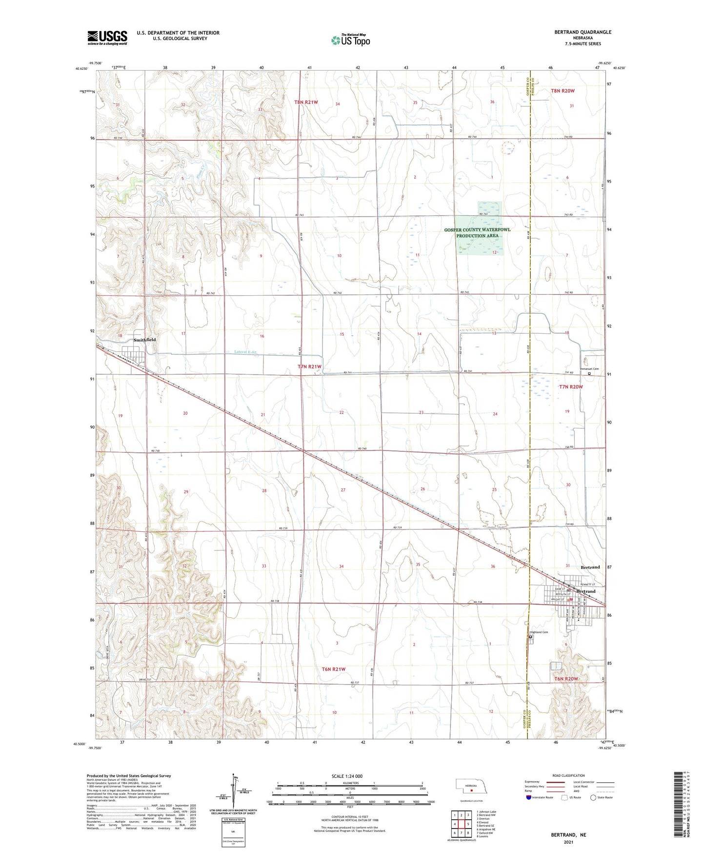
2021 topographic map quadrangle Bertrand in the state of Nebraska. Scale: 1:24000. Based on the newly updated USGS 7.5' US Topo map series, this map is in the following counties: Gosper, Phelps. The map contains contour data, water features, and other items you are used to seeing on USGS maps, but also has updated roads and other features. This is the next generation of topographic maps. Printed on high-quality waterproof paper with UV fade-resistant inks.
Quads adjacent to this one:
West: Elwood
Northwest: Johnson Lake
North: Bertrand NW
Northeast: Overton
East: Bertrand SE
Southeast: Loomis
South: Oxford NW
Southwest: Arapahoe NE
Contains the following named places: Adullam Lutheran Church, Agri Co-op Elevator, Bertrand, Bertrand City and Rural Fire Department, Bertrand Historical Marker, Bertrand Nursing Home, Bertrand Park, Bertrand Post Office, Bertrand Public Schools, Election Precinct 9, Hanson Field, Harrison Election Precinct, Highland Cemetery, Hi-Line Golf Course, Hope Church, Immanuel Cemetery, Immanuel Lutheran Church, Saint John Catholic Church, Saint Pauls Lutheran Church, Smithfield, Smithfield Post Office, Township of Harrison, United Methodist Church, Victor Lake Federal Waterfowl Production Area, Village of Bertrand, Village of Smithfield, ZIP Code: 68976