MyTopo
Bertrand NW Nebraska US Topo Map
Couldn't load pickup availability
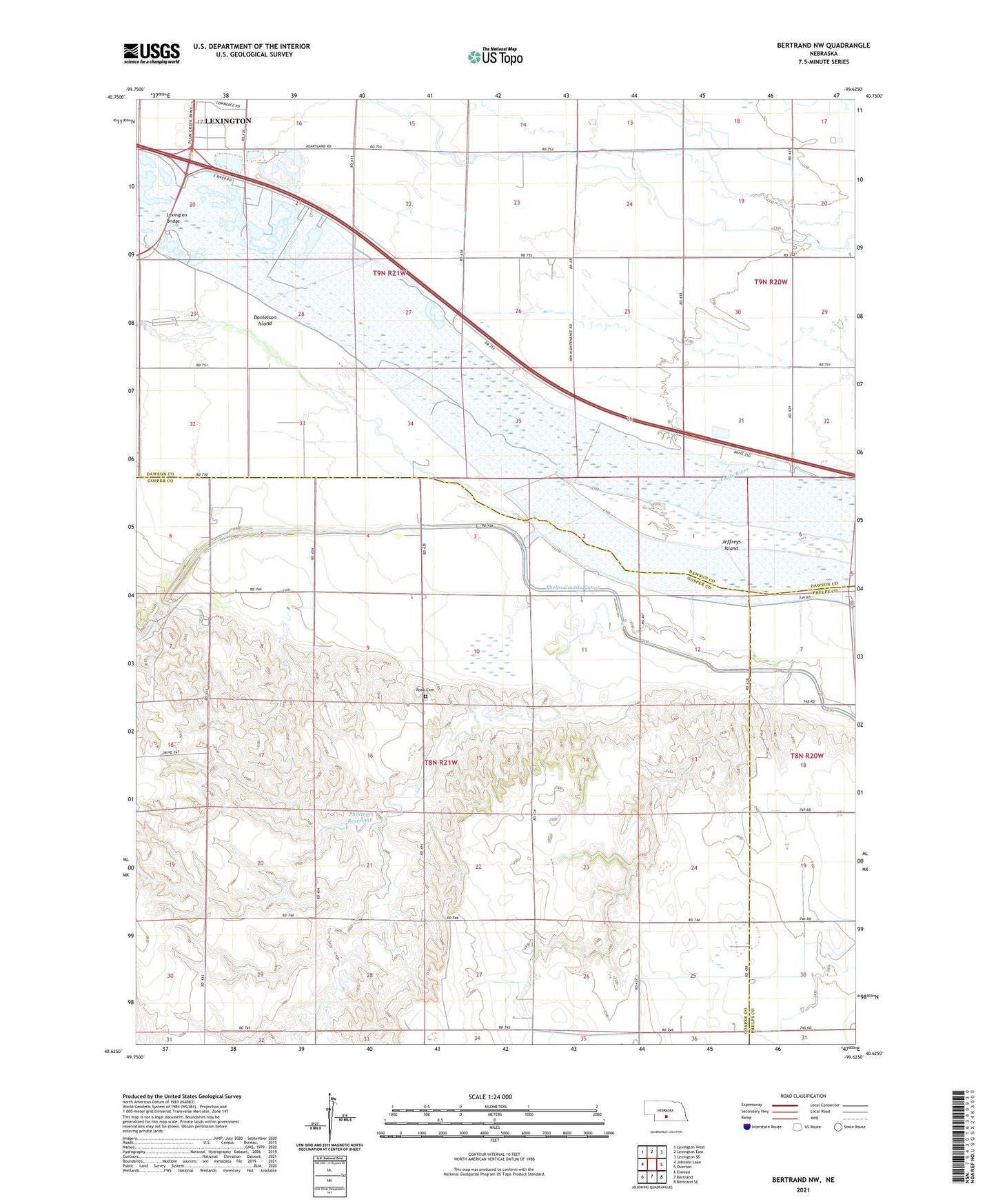
2021 topographic map quadrangle Bertrand NW in the state of Nebraska. Scale: 1:24000. Based on the newly updated USGS 7.5' US Topo map series, this map is in the following counties: Gosper, Dawson, Phelps. The map contains contour data, water features, and other items you are used to seeing on USGS maps, but also has updated roads and other features. This is the next generation of topographic maps. Printed on high-quality waterproof paper with UV fade-resistant inks.
Quads adjacent to this one:
West: Johnson Lake
Northwest: Lexington West
North: Lexington East
Northeast: Lexington SE
East: Overton
Southeast: Bertrand SE
South: Bertrand
Southwest: Elwood
This map covers the same area as the classic USGS quad with code o40099f6.
Contains the following named places: Beatty Ditch, Danielson Island, Earth Dam-Canal Mile 713 Dam, Heartland Museum of Military Vehicles, Lexington Bridge, Phillippi Dam, Phillippi Reservoir, Robb Cemetery, Robb Election Precinct, School Number 3, Spring Creek School, Township of Robb, Westminister Woods Camp, Westminster Woods Camp