MyTopo
Elwood Nebraska US Topo Map
Couldn't load pickup availability
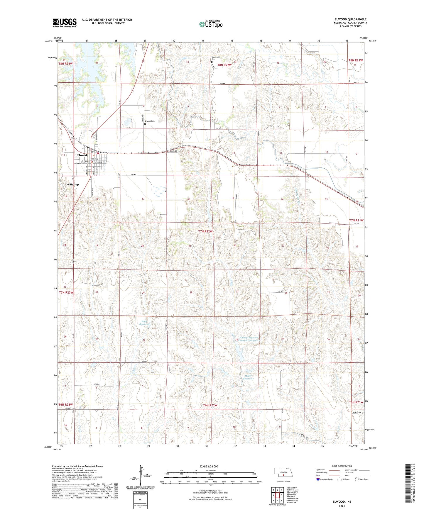
2021 topographic map quadrangle Elwood in the state of Nebraska. Scale: 1:24000. Based on the newly updated USGS 7.5' US Topo map series, this map is in the following counties: Gosper. The map contains contour data, water features, and other items you are used to seeing on USGS maps, but also has updated roads and other features. This is the next generation of topographic maps. Printed on high-quality waterproof paper with UV fade-resistant inks.
Quads adjacent to this one:
West: Elwood SW
Northwest: Elwood NW
North: Johnson Lake
Northeast: Bertrand NW
East: Bertrand
Southeast: Oxford NW
South: Arapahoe NE
Southwest: Arapahoe NW
This map covers the same area as the classic USGS quad with code o40099e7.
Contains the following named places: Bogle Dam, Bogle Reservoir, Christian Church, Devils Gap, Elwood, Elwood 7-22 Election Precinct, Elwood Care Center, Elwood Cemetery, Elwood Clinic, Elwood Post Office, Elwood Public Library, Elwood Public Schools, Elwood Rescue Unit, Elwood Volunteer Fire Department, Gosper County, Gosper County Courthouse, Gosper County Sheriff's Office, Lateral E-65, Meyer Dam, Meyer Reservoir, Our Redeemer Lutheran Church, Quakerville Cemetery, United Methodist Church, Village of Elwood, Whaley-Reynolds Dam Number 1, Whaley-Reynolds Reservoir Number 1