MyTopo
Overton Nebraska US Topo Map
Couldn't load pickup availability
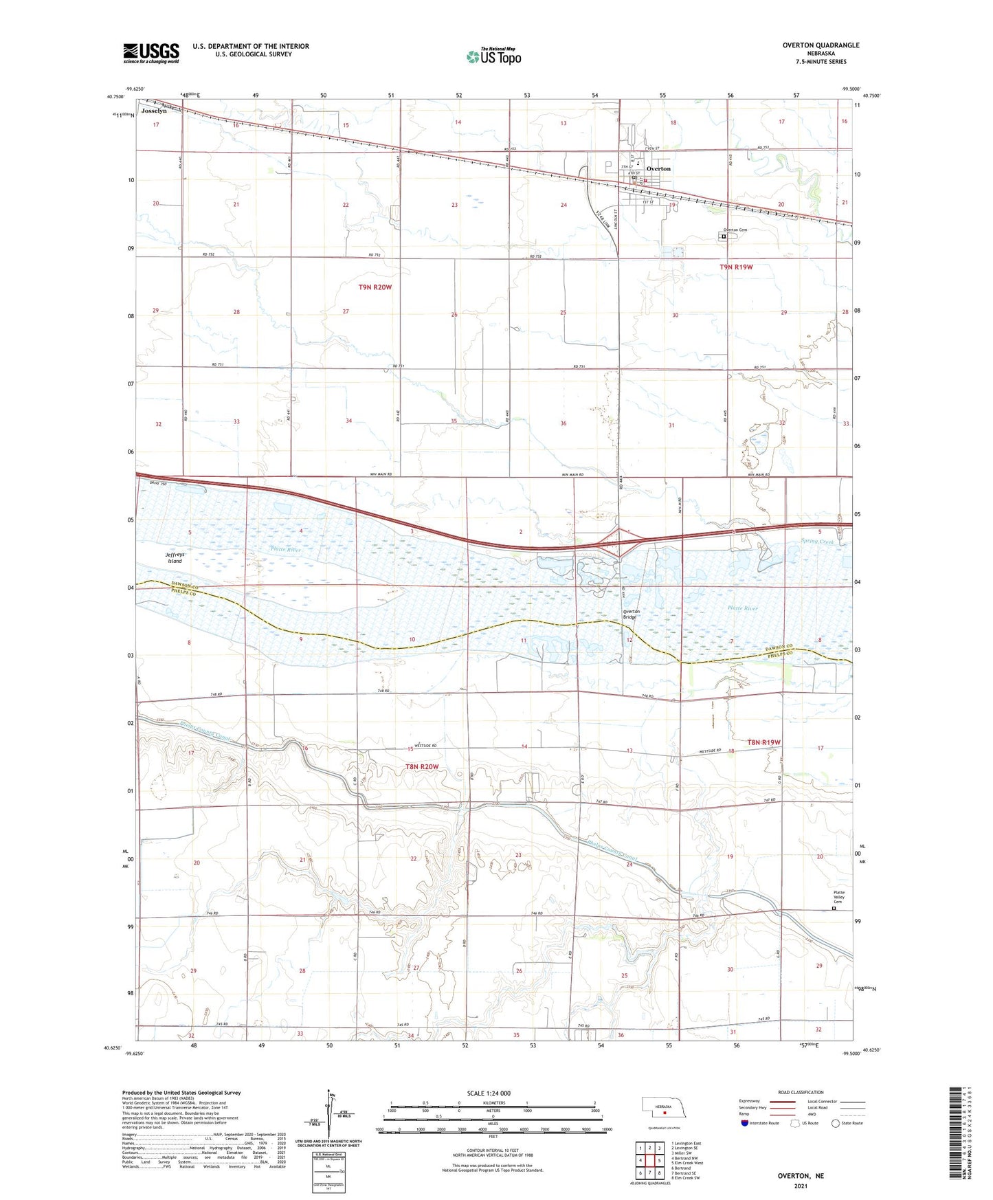
2021 topographic map quadrangle Overton in the state of Nebraska. Scale: 1:24000. Based on the newly updated USGS 7.5' US Topo map series, this map is in the following counties: Dawson, Phelps. The map contains contour data, water features, and other items you are used to seeing on USGS maps, but also has updated roads and other features. This is the next generation of topographic maps. Printed on high-quality waterproof paper with UV fade-resistant inks.
Quads adjacent to this one:
West: Bertrand NW
Northwest: Lexington East
North: Lexington SE
Northeast: Miller SW
East: Elm Creek West
Southeast: Elm Creek SW
South: Bertrand SE
Southwest: Bertrand
This map covers the same area as the classic USGS quad with code o40099f5.
Contains the following named places: Adullam Church, Agri Co-op Elevator, Area Mobile Park, Dogwood State Wildlife Management Area, Election Precinct 2, Holy Rosary Church, Jeffreys Island, Johnson Dam, Josselyn, Josselyn Post Office, Northside Village Mobile Home Park, Overton, Overton Bridge, Overton Cemetery, Overton Community Library, Overton Golf Course, Overton Post Office, Overton Public Schools, Overton Volunteer Fire and Rescue Department, Peavey Grain Company Elevator, Platte Valley Cemetery, Plum Creek, School Number 48, Spring Creek, Tobin Indian Raid Historical Marker, Township of Grant, Township of Westside, United Methodist Church, Village of Overton, West Twelfth School