MyTopo
Bingham Nebraska US Topo Map
Couldn't load pickup availability
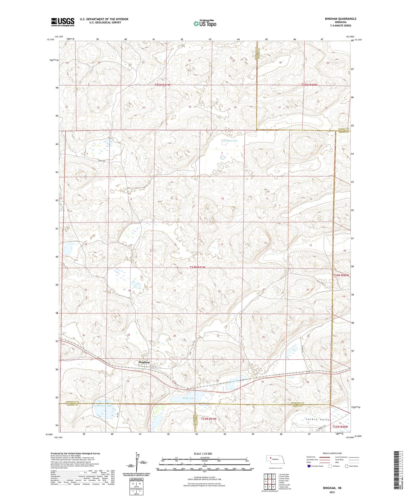
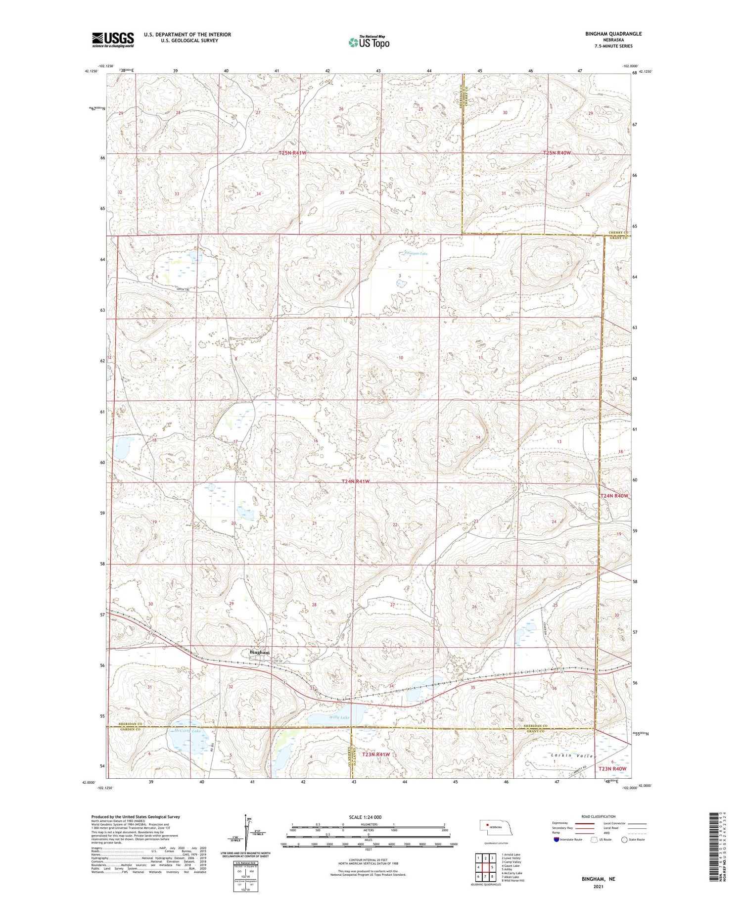
2021 topographic map quadrangle Bingham in the state of Nebraska. Scale: 1:24000. Based on the newly updated USGS 7.5' US Topo map series, this map is in the following counties: Sheridan, Grant, Cherry, Garden. The map contains contour data, water features, and other items you are used to seeing on USGS maps, but also has updated roads and other features. This is the next generation of topographic maps. Printed on high-quality waterproof paper with UV fade-resistant inks.
Quads adjacent to this one:
West: Gaunt Lake
Northwest: Arnold Lake
North: Lowe Valley
Northeast: Camp Valley
East: Ashby
Southeast: Wild Horse Hill
South: Alkali Lake
Southwest: McCarty Lake
Contains the following named places: Anderson Lake, Bingham, Bingham Congregational Church, Bingham Post Office, Bingham Public School, Cover West Ranch, District 85 Bingham School, Edmondson Ranch, Finnegan Lake, Finnegan Ranch, Larkin Valley, McCarty Lake, Powles Ranch, Sandcut, Sellers Ranch, Willy Lake, Willy Ranch, ZIP Code: 69335