MyTopo
Ashby Nebraska US Topo Map
Couldn't load pickup availability
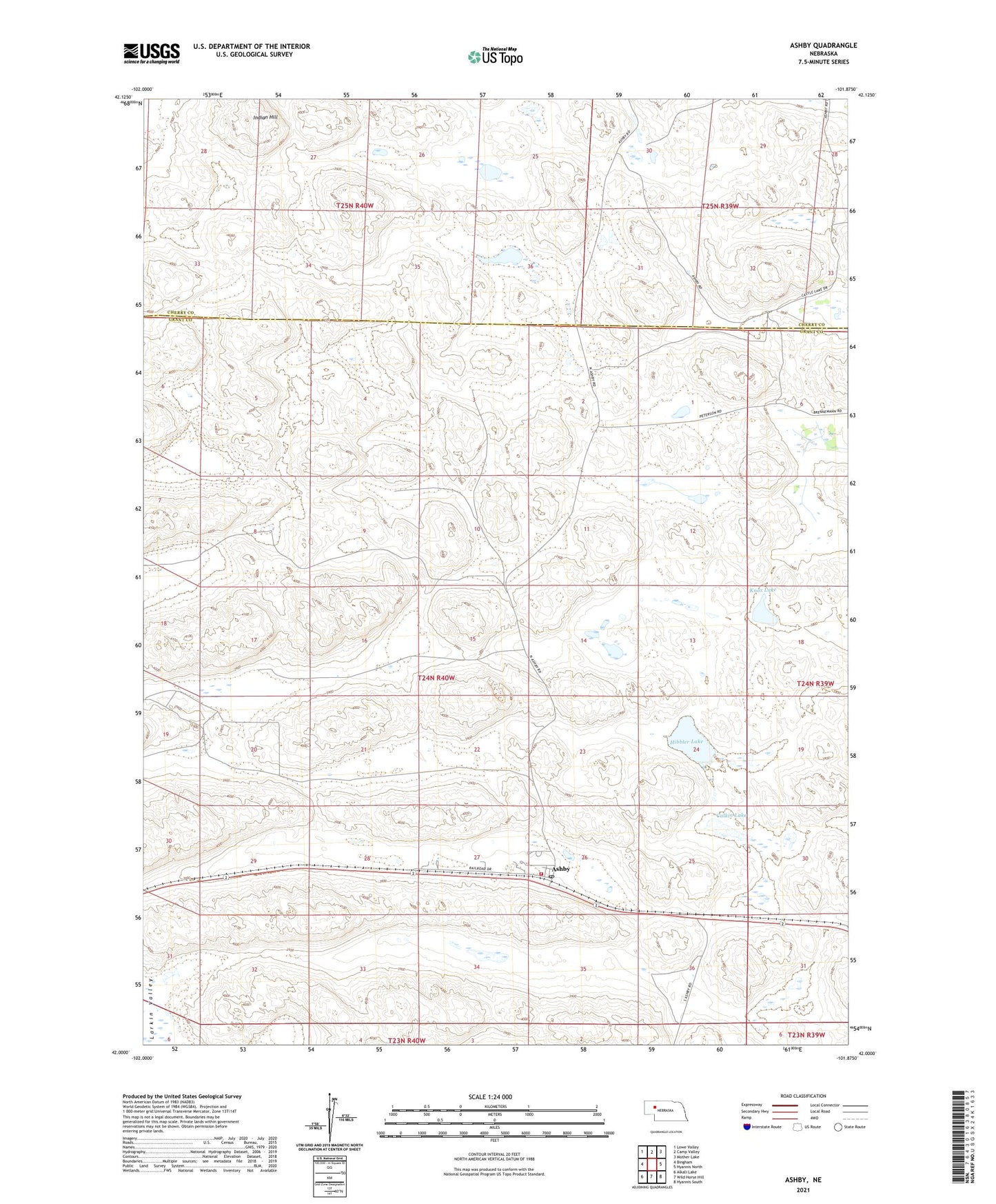
2021 topographic map quadrangle Ashby in the state of Nebraska. Scale: 1:24000. Based on the newly updated USGS 7.5' US Topo map series, this map is in the following counties: Grant, Cherry. The map contains contour data, water features, and other items you are used to seeing on USGS maps, but also has updated roads and other features. This is the next generation of topographic maps. Printed on high-quality waterproof paper with UV fade-resistant inks.
Quads adjacent to this one:
West: Bingham
Northwest: Lowe Valley
North: Camp Valley
Northeast: Mother Lake
East: Hyannis North
Southeast: Hyannis South
South: Wild Horse Hill
Southwest: Alkali Lake
This map covers the same area as the classic USGS quad with code o42101a8.
Contains the following named places: Ashby, Ashby Post Office, Ashby Public School, Ashby United Church of Christ, Calkin Lake, Castle Ranch, Hibbler Lake, Indian Hill, Knox Lake, Peterson Ranch, Sandhills Fire and Rescue Ashby Station, Swede Valley Lutheran Church, Thurston Ranch, ZIP Code: 69333