MyTopo
Gaunt Lake Nebraska US Topo Map
Couldn't load pickup availability
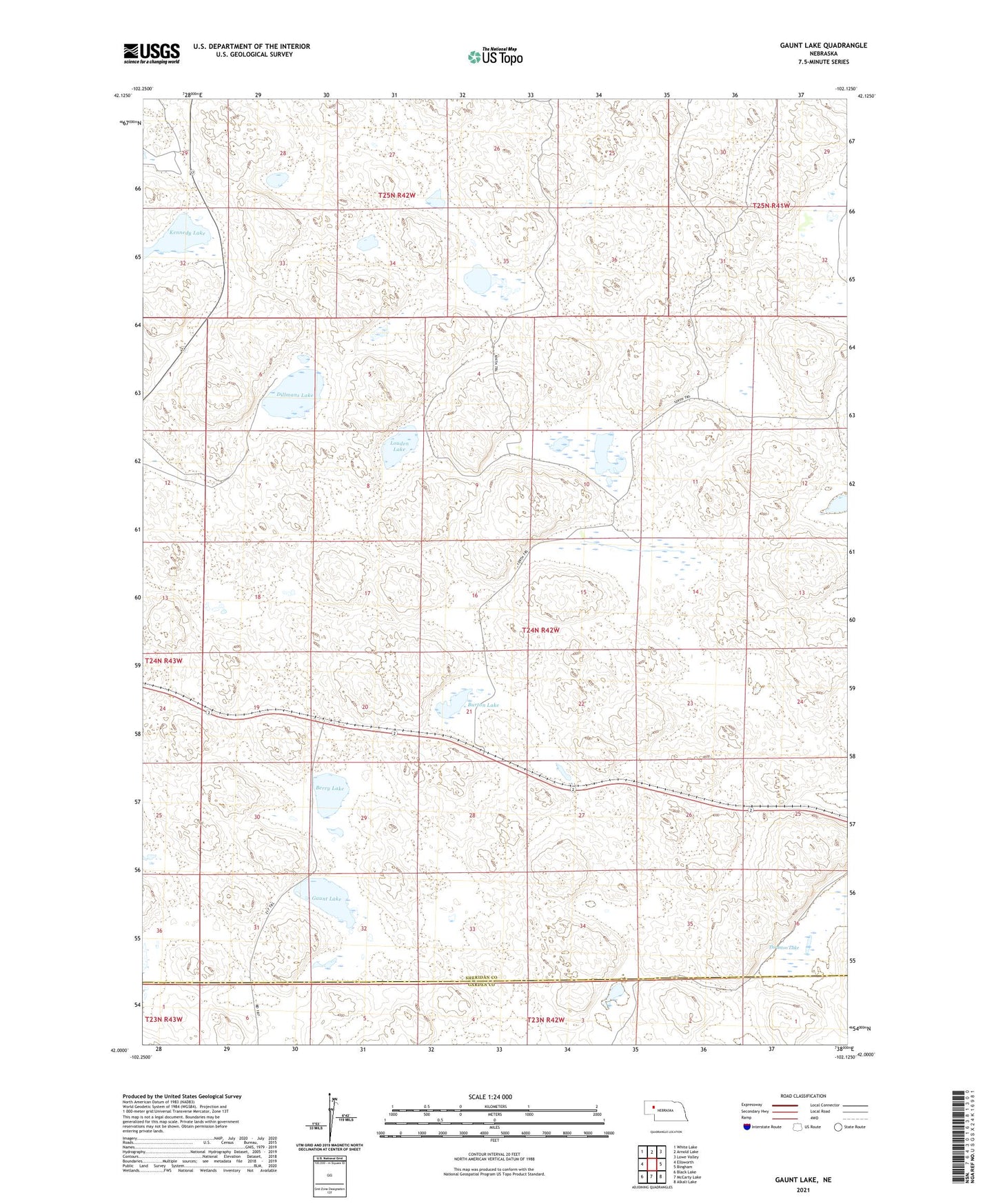
2021 topographic map quadrangle Gaunt Lake in the state of Nebraska. Scale: 1:24000. Based on the newly updated USGS 7.5' US Topo map series, this map is in the following counties: Sheridan, Garden. The map contains contour data, water features, and other items you are used to seeing on USGS maps, but also has updated roads and other features. This is the next generation of topographic maps. Printed on high-quality waterproof paper with UV fade-resistant inks.
Quads adjacent to this one:
West: Ellsworth
Northwest: White Lake
North: Arnold Lake
Northeast: Lowe Valley
East: Bingham
Southeast: Alkali Lake
South: McCarty Lake
Southwest: Black Lake
This map covers the same area as the classic USGS quad with code o42102a2.
Contains the following named places: Berry Lake, Burton Lake, Burton School, Carmichael Lake, Dillmans Lake, Ellsworth Election Precinct, Gaunt Lake, Kennedy Lake, Koch Ranch, Louden Lake, Thruston Lake, Von Krosigh Lake