MyTopo
Bordeaux Nebraska US Topo Map
Couldn't load pickup availability
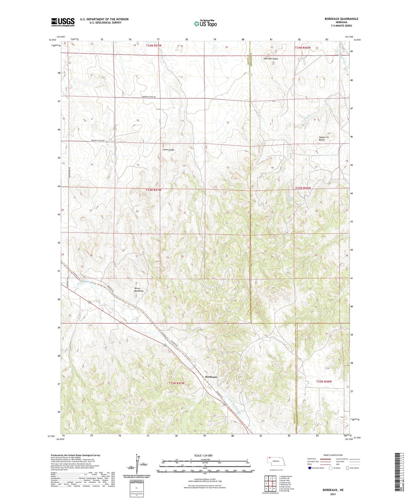
2023 topographic map quadrangle Bordeaux in the state of Nebraska. Scale: 1:24000. Based on the newly updated USGS 7.5' US Topo map series, this map is in the following counties: Dawes, Sheridan. The map contains contour data, water features, and other items you are used to seeing on USGS maps, but also has updated roads and other features. This is the next generation of topographic maps. Printed on high-quality waterproof paper with UV fade-resistant inks.
Quads adjacent to this one:
West: Chadron East
Northwest: Isinglass Buttes
North: Chadron NE
Northeast: Beaver Wall
East: Whiteclay SW
Southeast: Hay Springs
South: Hay Springs Creek
Southwest: Kings Canyon
This map covers the same area as the classic USGS quad with code o42102g7.
Contains the following named places: Bordeaux, Bordeaux Post Office, Cilek Creek, Devils Backbone, Lovers Leap, Sheridan Gates, Squaw Tit Butte