MyTopo
Hay Springs Nebraska US Topo Map
Couldn't load pickup availability
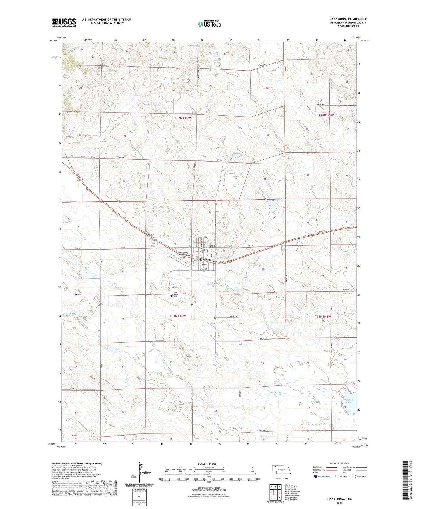
2021 topographic map quadrangle Hay Springs in the state of Nebraska. Scale: 1:24000. Based on the newly updated USGS 7.5' US Topo map series, this map is in the following counties: Sheridan. The map contains contour data, water features, and other items you are used to seeing on USGS maps, but also has updated roads and other features. This is the next generation of topographic maps. Printed on high-quality waterproof paper with UV fade-resistant inks.
Quads adjacent to this one:
West: Hay Springs Creek
Northwest: Bordeaux
North: Whiteclay SW
Northeast: Whiteclay SE
East: Hay Springs NE
Southeast: Hay Springs SE
South: Hay Springs SW
Southwest: Sand Canyon East
This map covers the same area as the classic USGS quad with code o42102f6.
Contains the following named places: Camp Sheridan and Spotted Tail Agency Historical Marker, Corner School, Cravath Memorial Library, Davis Dam, Davis Reservoir, Goldenrod School, Hay Springs, Hay Springs Cemetery, Hay Springs Creek, Hay Springs Election Precinct, Hay Springs Elementary School, Hay Springs High School, Hay Springs Medical Clinic, Hay Springs Municipal Airport, Hay Springs Post Office, Hay Springs Volunteer Fire Department, Heritage Center I, Heritage Center II, Linden Dam, Linden Reservoir, Northwest Grain Company Limited Elevator, Pioneer Manor Nursing Home, Saint Columbkille Catholic Church, Saint Marys Cemetery, United Methodist Church, Village of Hay Springs, Walgren Lake, Walgren Lake Camping Area, Walgren Lake State Recreation Area, Zion Lutheran Church