MyTopo
Brock Nebraska US Topo Map
Couldn't load pickup availability
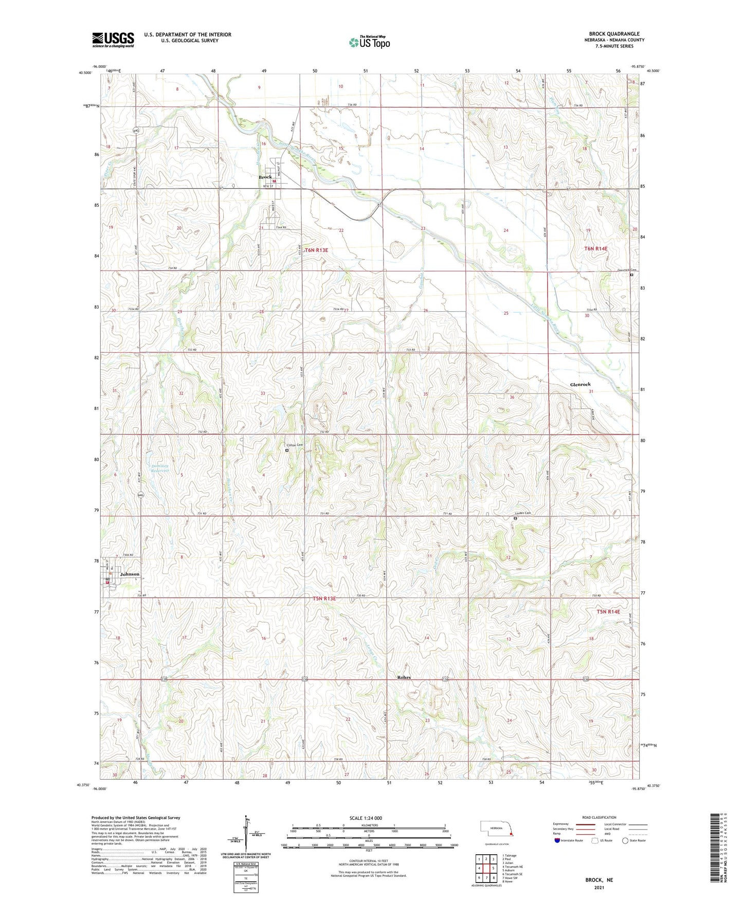
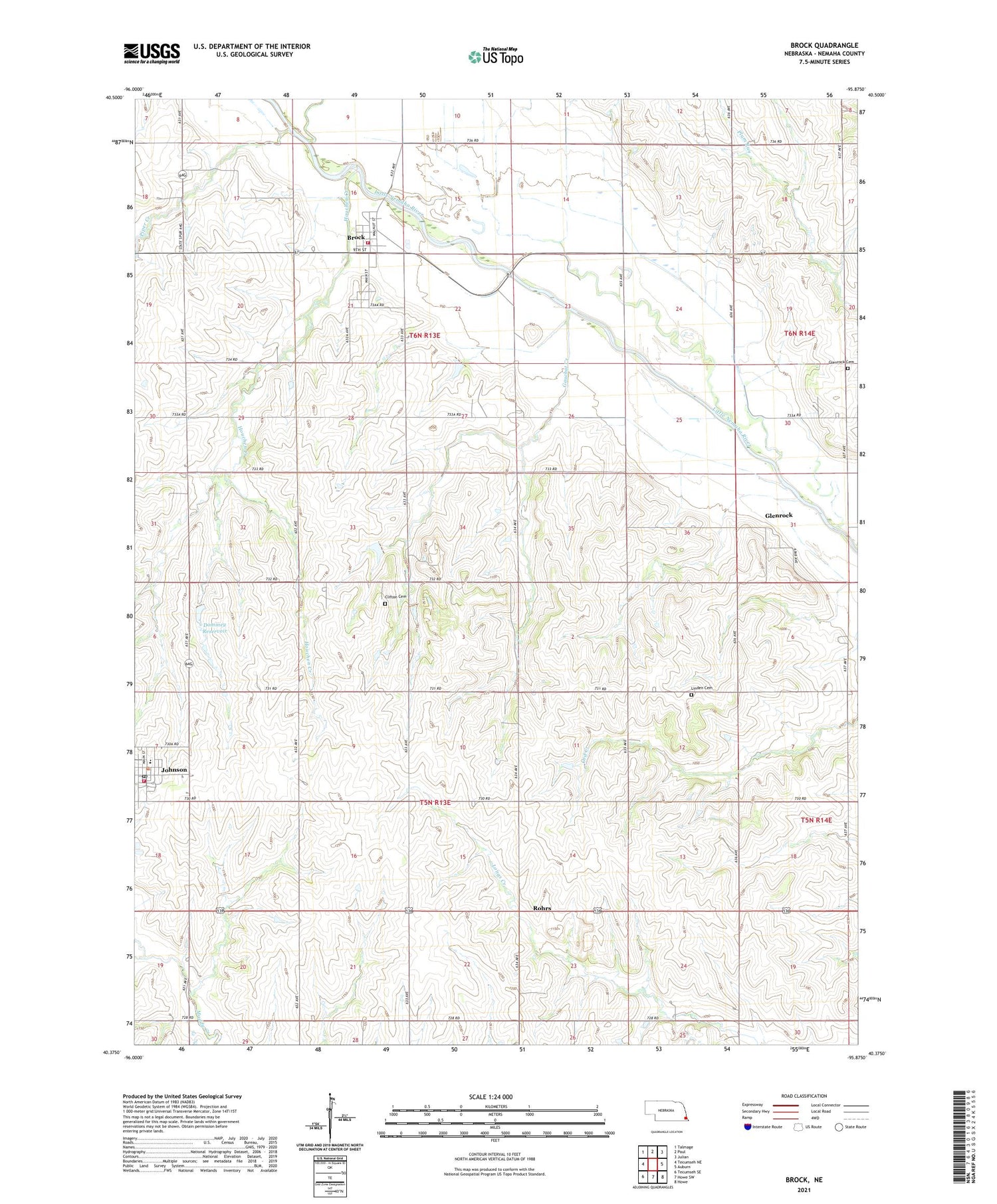
2021 topographic map quadrangle Brock in the state of Nebraska. Scale: 1:24000. Based on the newly updated USGS 7.5' US Topo map series, this map is in the following counties: Nemaha. The map contains contour data, water features, and other items you are used to seeing on USGS maps, but also has updated roads and other features. This is the next generation of topographic maps. Printed on high-quality waterproof paper with UV fade-resistant inks.
Quads adjacent to this one:
West: Tecumseh NE
Northwest: Talmage
North: Paul
Northeast: Julian
East: Auburn
Southeast: Howe
South: Howe SW
Southwest: Tecumseh SE
Contains the following named places: Brock, Brock Christian Church, Brock Post Office, Brock Rural Fire Department, Brock School, Clark Grain Company Elevator, Clifton Cemetery, Corvell Park, Coryell Chapel, Dayton Post Office, Dominey Reservoir, Dominy Dam, Gauchat Creek, Gauchat Group Dam, Gauchat Group Reservoir, Glenrock, Glenrock Cemetery, Glenrock Post Office, Houchen Creek, Johnson, Johnson Area Quick Response Team, Johnson Post Office, Johnson Volunteer Fire Department, Johnson-Brock Public Schools, Lafayette Election Precinct, Linden Cemetery, Linden School, Piper Creek, Rohrs, Rohrs Post Office, Saint Matthew Lutheran Church, Saint Pauls Church, Township of Lafayette, Township of Washington, United Methodist Church, Village of Brock, Village of Johnson, Washington Election Precinct, ZIP Code: 68320