MyTopo
Tecumseh NE Nebraska US Topo Map
Couldn't load pickup availability
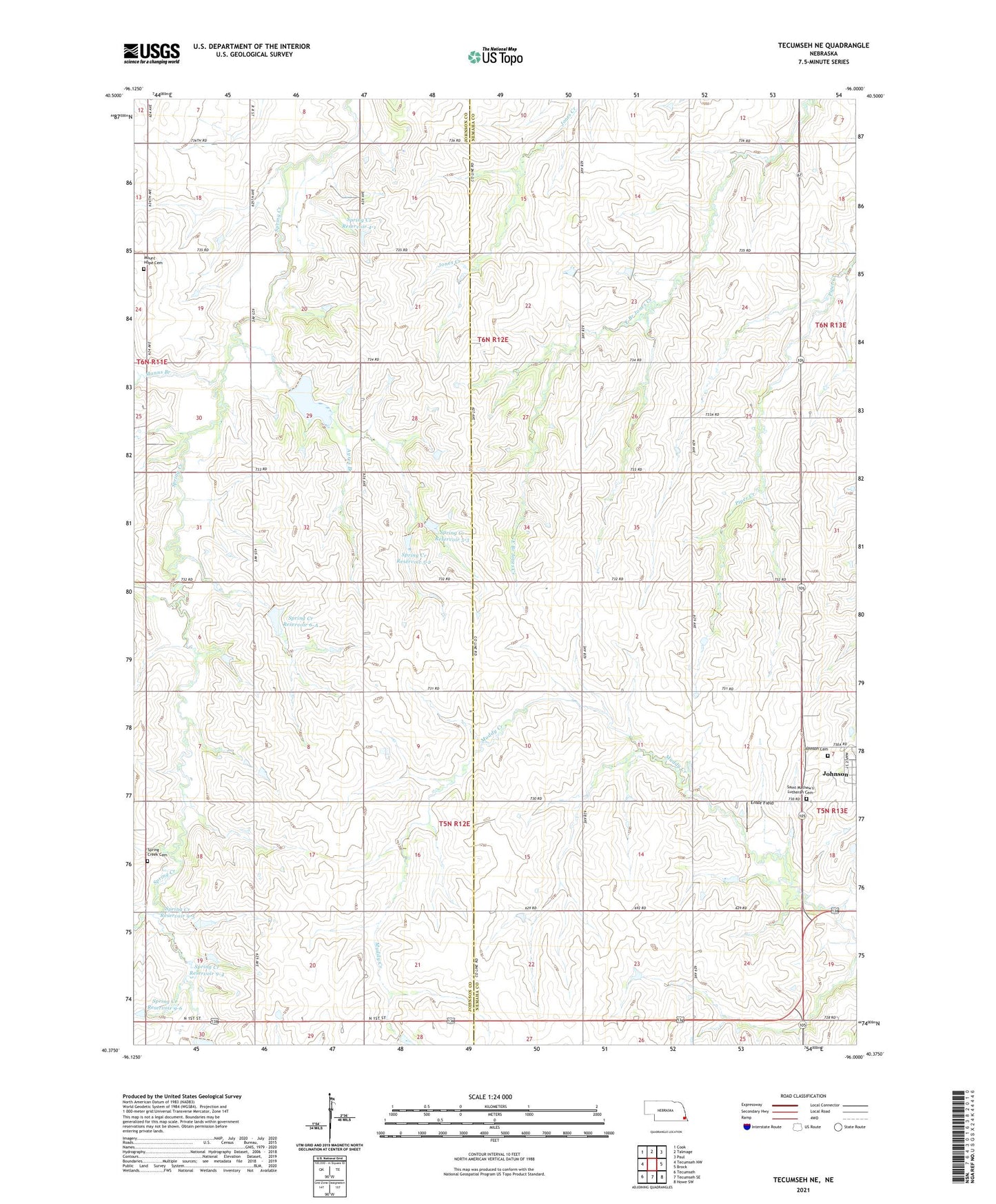
2021 topographic map quadrangle Tecumseh NE in the state of Nebraska. Scale: 1:24000. Based on the newly updated USGS 7.5' US Topo map series, this map is in the following counties: Johnson, Nemaha. The map contains contour data, water features, and other items you are used to seeing on USGS maps, but also has updated roads and other features. This is the next generation of topographic maps. Printed on high-quality waterproof paper with UV fade-resistant inks.
Quads adjacent to this one:
West: Tecumseh NW
Northwest: Cook
North: Talmage
Northeast: Paul
East: Brock
Southeast: Howe SW
South: Tecumseh SE
Southwest: Tecumseh
This map covers the same area as the classic USGS quad with code o40096d1.
Contains the following named places: Ayres Branch, Ensor Field, Graf, Graf Post Office, Johnson Cemetery, Lincoln Election Precinct, Manns Branch, Mount Hope Cemetery, Saint Mathew's Lutheran Cemetery, Spring Creek Cemetery, Spring Creek Dam 4-1, Spring Creek Dam 5-2, Spring Creek Dam 5-3, Spring Creek Dam 5-A, Spring Creek Dam 6-A, Spring Creek Dam 9-4, Spring Creek Dam 9-5, Spring Creek Dam 9-6, Spring Creek Dam 9-A, Spring Creek Reservoir 4-1, Spring Creek Reservoir 5-2, Spring Creek Reservoir 5-3, Spring Creek Reservoir 5-A, Spring Creek Reservoir 6-A, Spring Creek Reservoir 9-4, Spring Creek Reservoir 9-5, Spring Creek Reservoir 9-6, Spring Creek School Number 19, Spring Creek School Number 21, Township of Lincoln, Zion Church, ZIP Code: 68378