MyTopo
Paul Nebraska US Topo Map
Couldn't load pickup availability
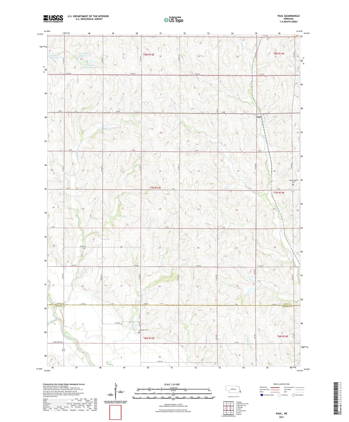
2021 topographic map quadrangle Paul in the state of Nebraska. Scale: 1:24000. Based on the newly updated USGS 7.5' US Topo map series, this map is in the following counties: Otoe, Nemaha. The map contains contour data, water features, and other items you are used to seeing on USGS maps, but also has updated roads and other features. This is the next generation of topographic maps. Printed on high-quality waterproof paper with UV fade-resistant inks.
Quads adjacent to this one:
West: Talmage
Northwest: Dunbar
North: Nebraska City NW
Northeast: Nebraska City
East: Julian
Southeast: Auburn
South: Brock
Southwest: Tecumseh NE
This map covers the same area as the classic USGS quad with code o40095e8.
Contains the following named places: Bloomingdale Cemetery, Demey Dam, Demey Reservoir, Heirs Dam, Jones Creek, Lafayette Cemetery, Lincoln Grove School, Paul, Paul Post Office, Rock Creek Election Precinct, Saint Josephs Church, Saint Pauls Church, Sand Creek, Township of Otoe, Township of Rock Creek, Wilson Creek Dam 1-10, Wilson Creek Reservoir 1-10, Wilson Creek Reservoir 1-9, Zion Public School