MyTopo
Julian Nebraska US Topo Map
Couldn't load pickup availability
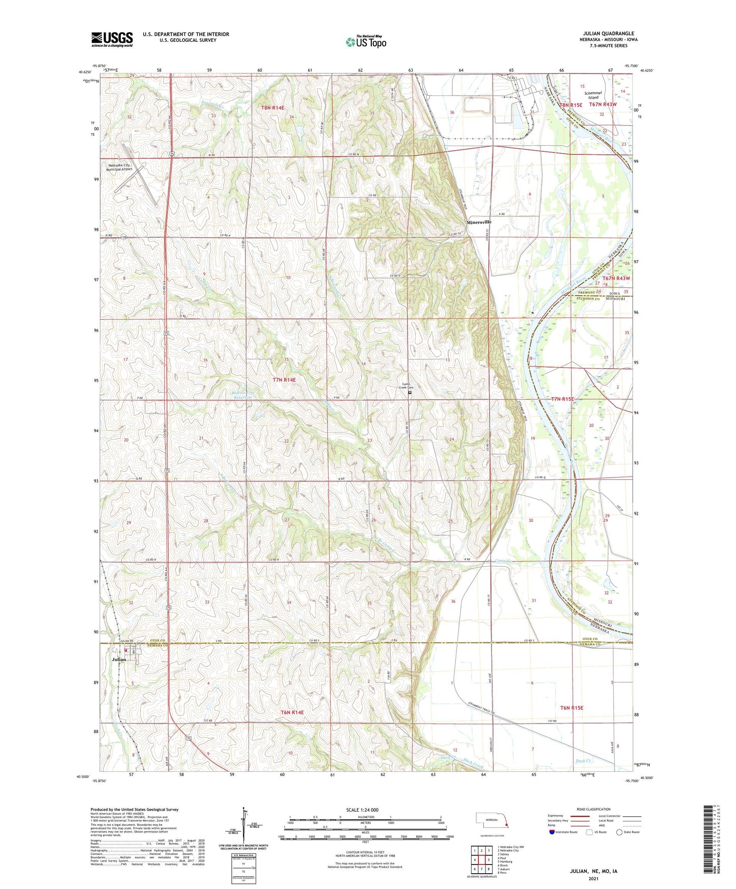
2021 topographic map quadrangle Julian in the states of Nebraska, Missouri, Iowa. Scale: 1:24000. Based on the newly updated USGS 7.5' US Topo map series, this map is in the following counties: Otoe, Nemaha, Atchison, Fremont. The map contains contour data, water features, and other items you are used to seeing on USGS maps, but also has updated roads and other features. This is the next generation of topographic maps. Printed on high-quality waterproof paper with UV fade-resistant inks.
Quads adjacent to this one:
West: Paul
Northwest: Nebraska City NW
North: Nebraska City
Northeast: Sidney
East: Hamburg
Southeast: Peru
South: Auburn
Southwest: Brock
This map covers the same area as the classic USGS quad with code o40095e7.
Contains the following named places: Arbor, Barney, Buffalo City Dam, Buffalo City Reservoir, Camp Creek, Camp Creek Cemetery, Camp Creek Chapel, Camp Creek Post Office, Camp Creek School, Duck Creek, Gress Farms Airport, Harmony School, Hazel Dell Public School, Julian, Julian Ag Service Elevator, Julian Post Office, Julian Volunteer Fire Department, Minersville, Minersville Post Office, Nebraska City Municipal Airport, North Branch Camp Creek, Northwest Missouri Planning District, Olson, Otoe City Post Office, Otoe Election Precinct, Platte Purchase, Pleasant Grove School, Saint Bernards Church, Schemmel Island, South Branch Camp Creek, Steamboat Trace Trail, United Methodist Church, Village of Julian, ZIP Code: 68379