MyTopo
Brownson Nebraska US Topo Map
Couldn't load pickup availability
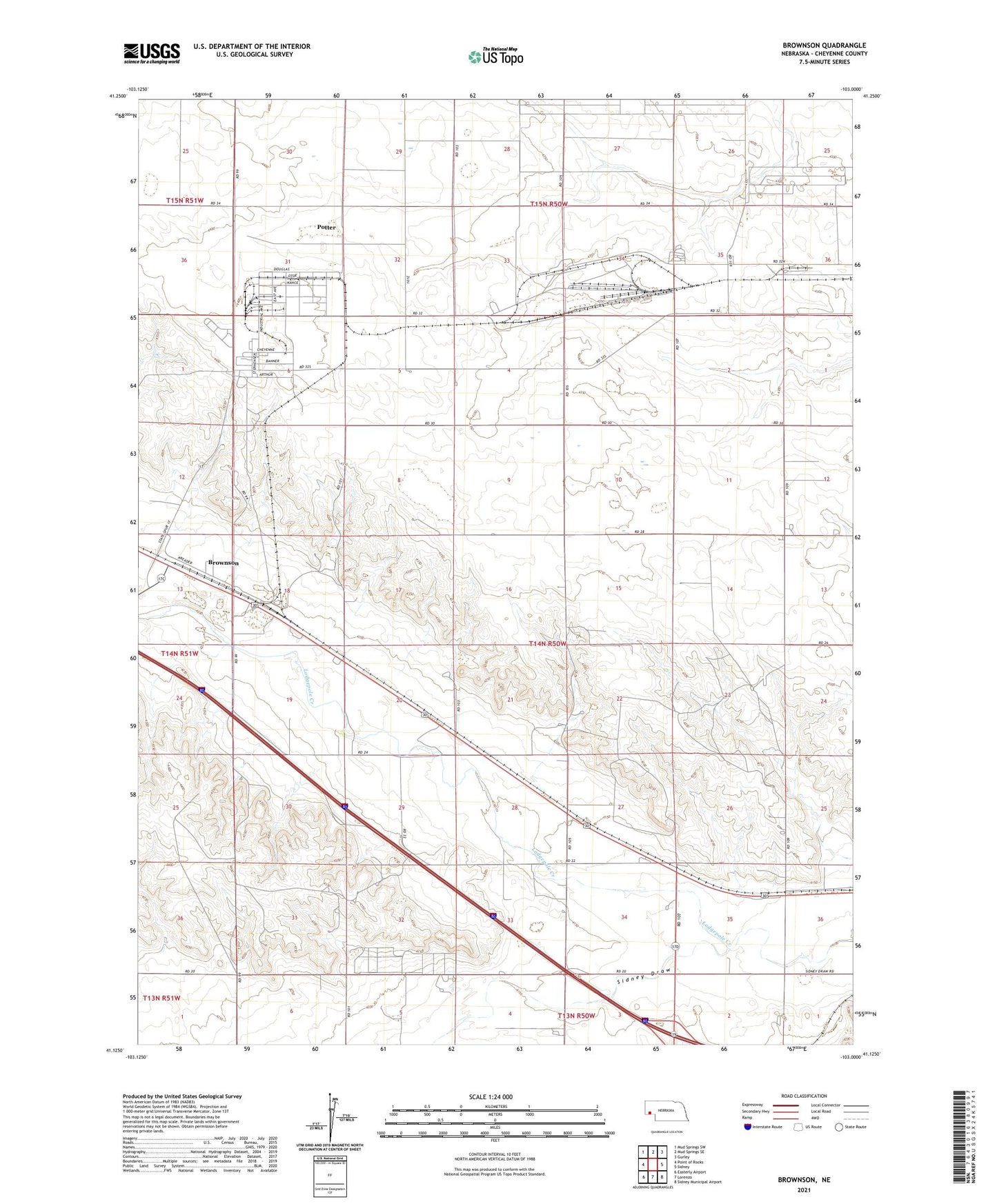
2021 topographic map quadrangle Brownson in the state of Nebraska. Scale: 1:24000. Based on the newly updated USGS 7.5' US Topo map series, this map is in the following counties: Cheyenne. The map contains contour data, water features, and other items you are used to seeing on USGS maps, but also has updated roads and other features. This is the next generation of topographic maps. Printed on high-quality waterproof paper with UV fade-resistant inks.
Quads adjacent to this one:
West: Point of Rocks
Northwest: Mud Springs SW
North: Mud Springs SE
Northeast: Gurley
East: Sidney
Southeast: Sidney Municipal Airport
South: Lorenzo
Southwest: Easterly Airport
Contains the following named places: Beyer Dam, Beyer Reservoir, Bronson Post Office, Brownson, Cheyenne County Historical Marker, Er-Runge Reservoir, Margate, Ordville, School Number 36, Sidney Draw, Sidney Eastbound Travel Information Center, Sidney Rest Area, Sioux Army Depot Historical Marker, The Golden Link Historical Marker, Tobler-Runge Dam, Village of Potter, Western Nebraska Community College Airport, Western Nebraska Technical College, ZIP Code: 69162