MyTopo
Lorenzo Nebraska US Topo Map
Couldn't load pickup availability
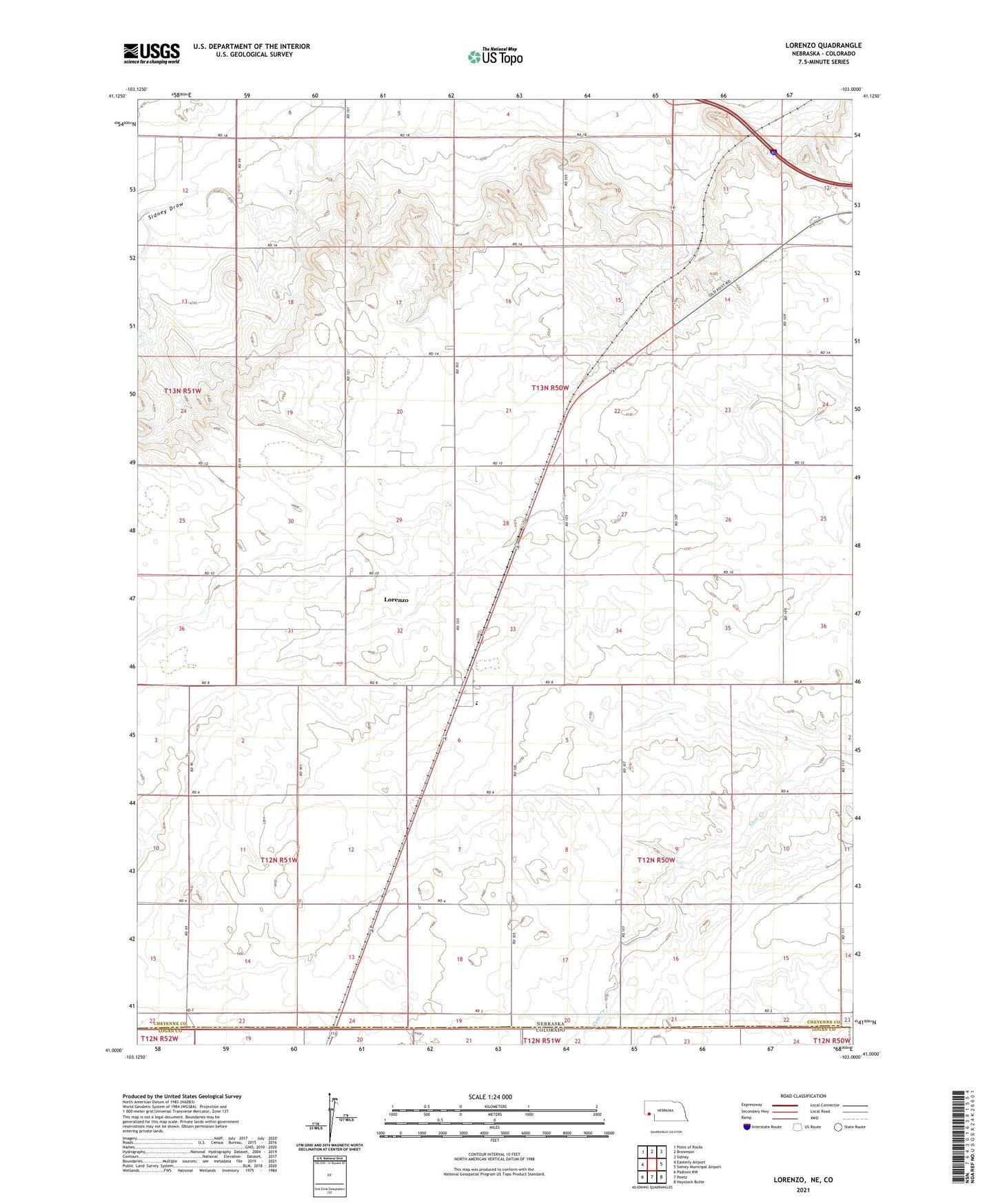
2021 topographic map quadrangle Lorenzo in the state of Nebraska. Scale: 1:24000. Based on the newly updated USGS 7.5' US Topo map series, this map is in the following counties: Cheyenne, Logan. The map contains contour data, water features, and other items you are used to seeing on USGS maps, but also has updated roads and other features. This is the next generation of topographic maps. Printed on high-quality waterproof paper with UV fade-resistant inks.
Quads adjacent to this one:
West: Easterly Airport
Northwest: Point of Rocks
North: Brownson
Northeast: Sidney
East: Sidney Municipal Airport
Southeast: Haystack Butte
South: Peetz
Southwest: Padroni NW
This map covers the same area as the classic USGS quad with code o41103a1.
Contains the following named places: Crossroads Cooperative Association Elevator, Lorenzo, Lorenzo Census Designated Place, Lorenzo Post Office, Lorenzo Public School, Phelps Airport, Sidney 4 Election Precinct