MyTopo
Callaway Nebraska US Topo Map
Couldn't load pickup availability
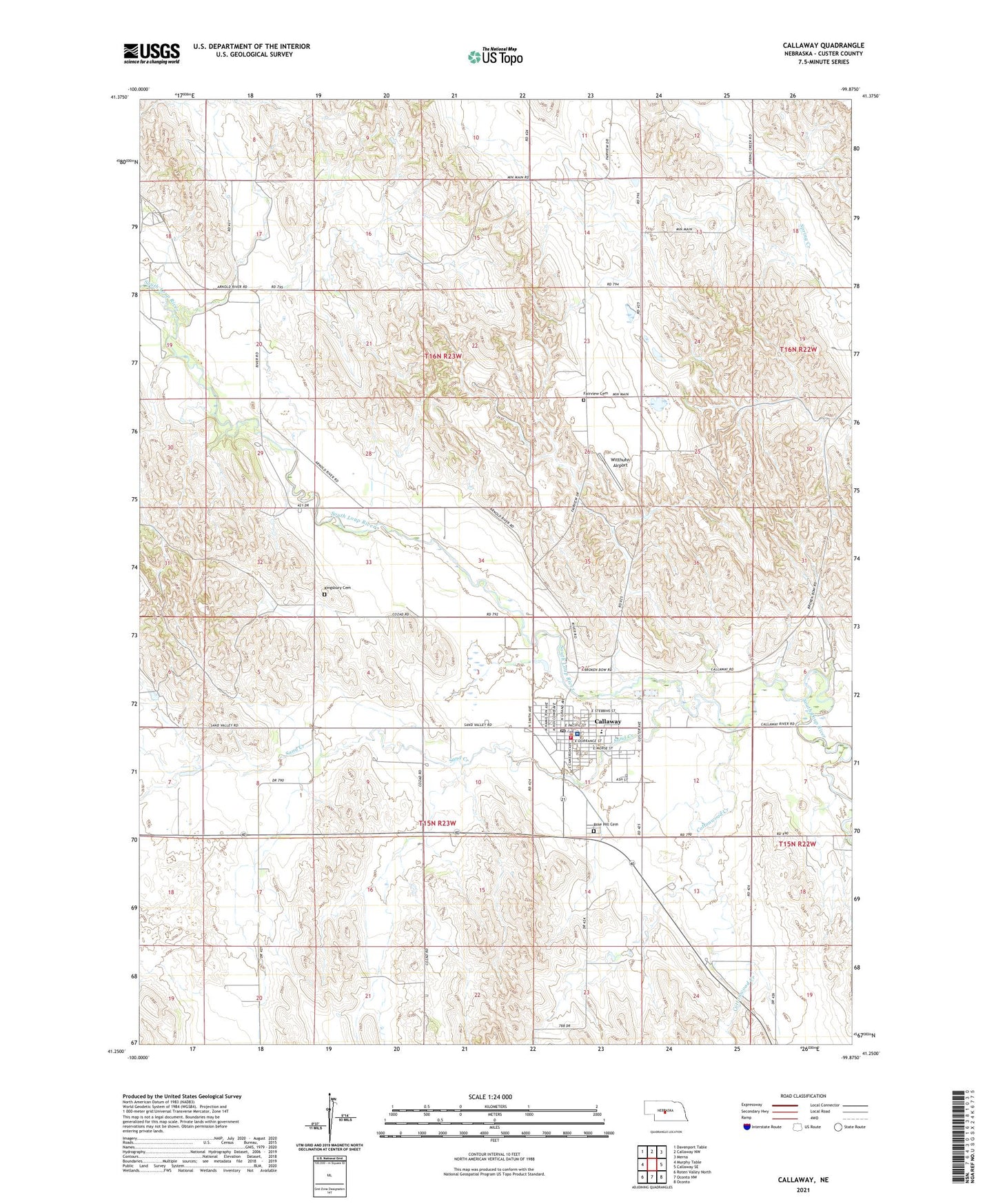
2021 topographic map quadrangle Callaway in the state of Nebraska. Scale: 1:24000. Based on the newly updated USGS 7.5' US Topo map series, this map is in the following counties: Custer. The map contains contour data, water features, and other items you are used to seeing on USGS maps, but also has updated roads and other features. This is the next generation of topographic maps. Printed on high-quality waterproof paper with UV fade-resistant inks.
Quads adjacent to this one:
West: Murphy Table
Northwest: Davenport Table
North: Callaway NW
Northeast: Merna
East: Callaway SE
Southeast: Oconto
South: Oconto NW
Southwest: Roten Valley North
This map covers the same area as the classic USGS quad with code o41099c8.
Contains the following named places: Brown Valley School, Callaway, Callaway Community Church, Callaway District Hospital and Clinic, Callaway Feeds Elevator, Callaway Golf Course, Callaway Good Samaritan Center, Callaway Lutheran Church, Callaway Medical Clinic, Callaway Mini Park, Callaway Police Department, Callaway Post Office, Callaway Public Schools, Callaway Rural Fire Department, Cottonwood Creek, Cross Roads School, Custer Countys First Courthouse Historical Marker, Evans School, Fairview Cemetery, Fairview School, Hoesel Airport, Kingsbury Cemetery, Morgan Park, Morgan Park Campground, New Callaway, Nigel Sprouse Memorial Library, Rose Hill Cemetery, Saint Boniface Catholic Church, Sand Creek, Seven Valleys Grain Company Elevator, Seven Valleys Museum, Township of Delight, Township of Triumph, Triumph Post Office, Triumph School, United Methodist Church, Village of Callaway, Whaley School, Witthuhn Airport, Woodward Trailer Park, ZIP Code: 68825