MyTopo
Oconto Nebraska US Topo Map
Couldn't load pickup availability
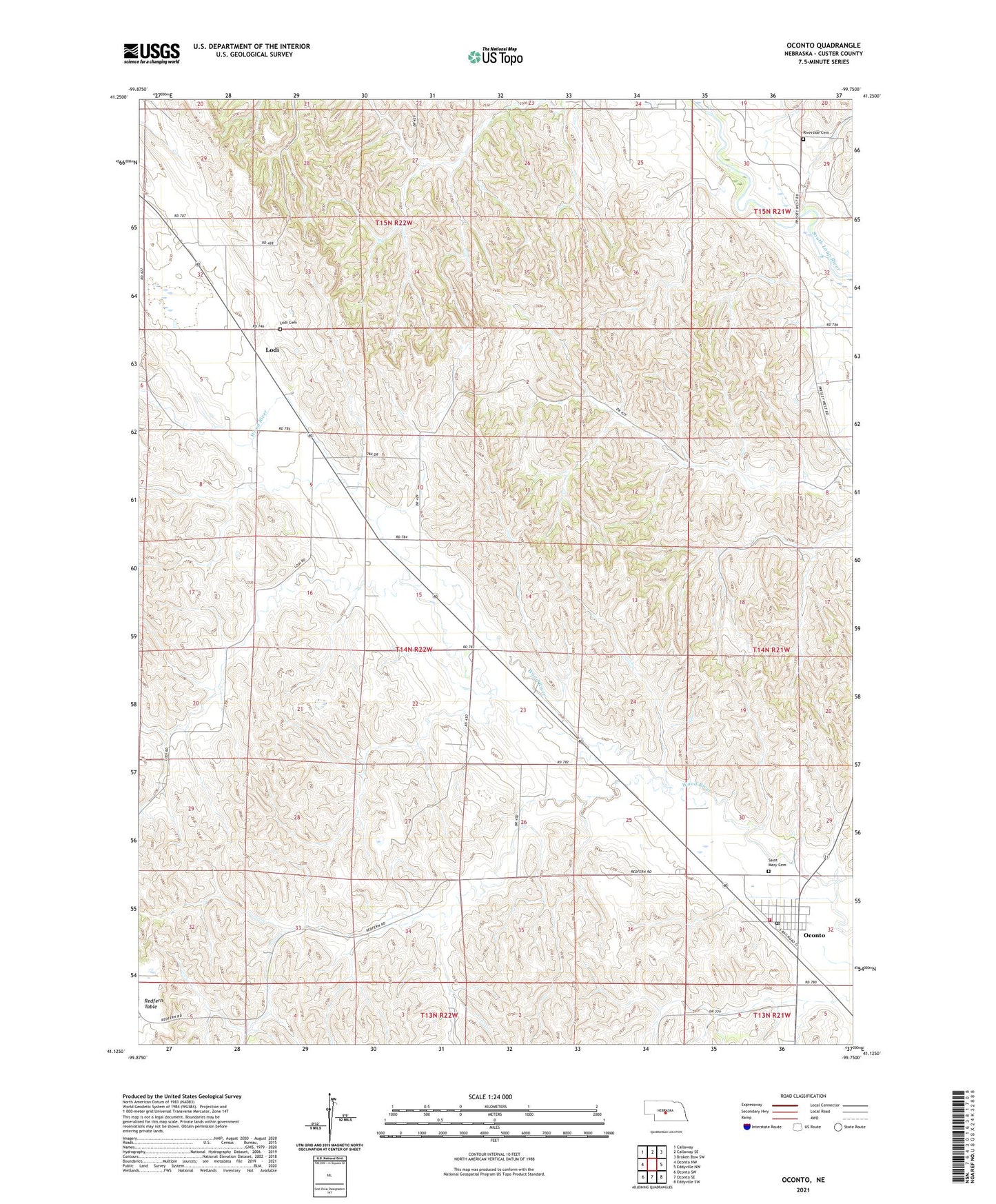
2021 topographic map quadrangle Oconto in the state of Nebraska. Scale: 1:24000. Based on the newly updated USGS 7.5' US Topo map series, this map is in the following counties: Custer. The map contains contour data, water features, and other items you are used to seeing on USGS maps, but also has updated roads and other features. This is the next generation of topographic maps. Printed on high-quality waterproof paper with UV fade-resistant inks.
Quads adjacent to this one:
West: Oconto NW
Northwest: Callaway
North: Callaway SE
Northeast: Broken Bow SW
East: Eddyville NW
Southeast: Eddyville SW
South: Oconto SE
Southwest: Oconto SW
This map covers the same area as the classic USGS quad with code o41099b7.
Contains the following named places: Lodi, Lodi Cemetery, Lodi Post Office, Lodi School, Lower Lodi School, Lucky Star School, Oconto, Oconto City Park, Oconto Library, Oconto Post Office, Oconto Public School, Oconto Volunteer Fire Department, Riverside Cemetery, Riverside School, Saint Mary Cemetery, Saint Marys Catholic Church, Township of Wood River, United Methodist Church, Village of Oconto, ZIP Code: 68860